Explore the North Indian Himalayas
Authoritative trail intelligence, high-altitude passes, technical summits, and verified logistics across Himachal, Uttarakhand, Ladakh, and Kashmir.
The Four Himalayan Territories
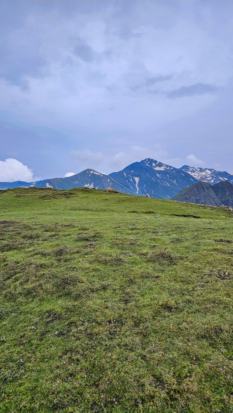
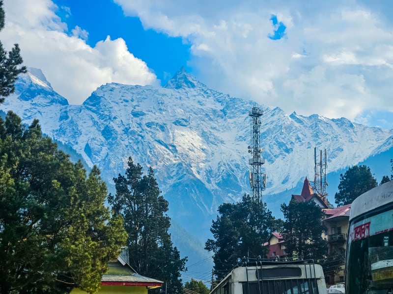
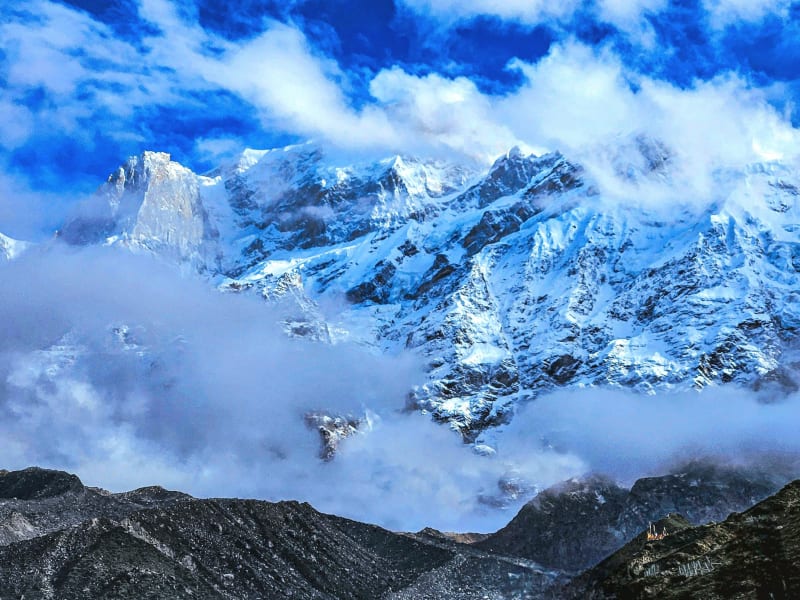
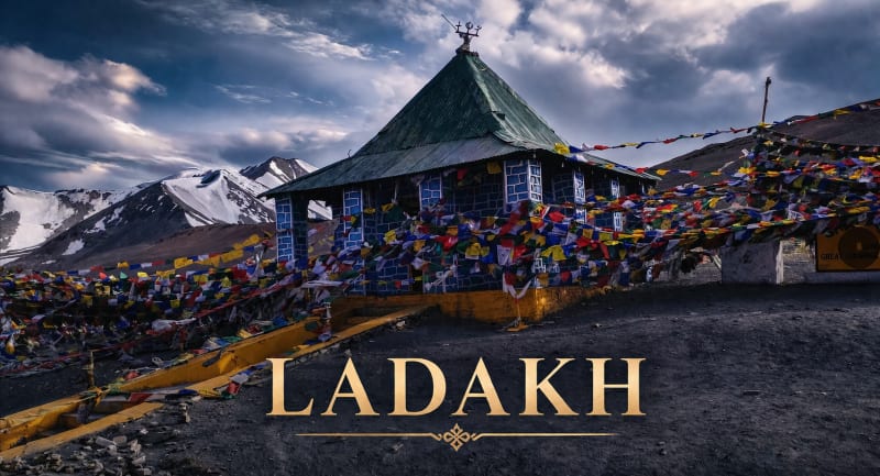
A branching geographic traverse across the 2,400km Indian Himalayan Arc. Choose your theatre of exploration.
Filter by Expedition Profile
Query all 172 verified destinations and expeditions across the northern ranges. Filter by category, territory, and technical difficulty.
Patnitop Meadow
Patnitop is a scenic hill resort situated on a plateau surrounded by dense deodar and pine forests in Udhampur district. It offers gentle ridge walks, cedar canopy trails, and paragliding with panoramic views of the Chenab basin.
Sanasar Lake & Meadow
Sanasar is a cup-shaped meadow surrounded by gigantic conifers, named after two local lakes (Sana and Sar). Known as the eco-adventure hub of Jammu, it features wilderness trails, camping, and golf greens.
Nathatop Ridge
Perched high above Patnitop, Nathatop offers a sweeping 360-degree vista of the snow-clad peaks of the Kishtwar and Pir Panjal mountain ranges. In winter, its gentle slopes become a playground for snow activities.
Vaishno Devi Trail
One of India's most revered mountain pilgrimages, the 13 km trek starts from Katra town and ascends through the Trikuta Mountains to the holy cave shrine of Mata Vaishno Devi.
Rajouri
Sited in the southern foothills of the Pir Panjal range along the Tawi River basin, Rajouri—historically known as Rajapuri ('Land of Kings')—is an ancient cultural crossroads and the southern springboard for exploration across the high Pir Panjal. Ringed by pine-forested hills and historic Mughal encampments, it features the 19th-century Dhanidhar Fort overlooking the town, sacred Sufi shrines, and direct access north toward the Mughal Road and the remote Seven Lakes of Rajouri.
Poonch
Bordered by the jagged snowy ridges of the Pir Panjal on three sides and flanked by the Poonch River, this historic frontier town is steeped in Himalayan heritage. Renowned for the imposing 18th-century Poonch Fort with its blend of Sikh, Mughal, and European architecture, tranquil apple and walnut orchards, and cascading mountain torrents like the Noori Chamb waterfall near Behramgala, Poonch marks the western terminus of the historic Mughal Road across the Pir Panjal.
Dera Ki Gali
Perched at over 2,050 meters on the ridge divide between Rajouri and Poonch districts, Dera Ki Gali (often abbreviated as DKG) is a tranquil forest pass enveloped in virgin deodar, blue pine, and oak trees. The high pass provides refreshing alpine cool, panoramic vistas of the southern Pir Panjal slopes, and serves as an important junction linking Thanamandi with Bafliaz and the historic Mughal Road corridor.
Pir Ki Gali
Pir Ki Gali is the iconic high-altitude mountain pass at 3,485 meters (11,433 ft) traversing the crest of the Pir Panjal range along the historic Mughal Road. Connecting Poonch and Rajouri in Jammu with Shopian in Kashmir, this windswept pass features rolling high-altitude meadows, herds of nomadic Gujjar and Bakarwal shepherds, and the revered roadside shrine (Ziarat) of Sufi saint Sheikh Ahmed Karim.
Kotranka (Bakori)
Known natively to locals as Bakori, Kotranka is a scenic foothill town and sub-divisional hub nestled in a verdant amphitheater along the Ans River in Rajouri district. Surrounded by terraced cornfields, sparkling streamlets, and pine-clad hillsides, Kotranka (Bakori) is the lively commercial crossroads and cultural heartland of the lower Pir Panjal. Away from highway congestion, it offers genuine insight into traditional Pahari and Gujjar rural Himalayan life and serves as an essential staging post on the route ascending toward Budhal and the untamed high alpine wilderness.
Budhal
Nestled in the rugged upper foothills of the southern Pir Panjal range in Rajouri district, Budhal is a high-altitude mountain settlement situated along the Gabbar River torrent. Characterized by terraced alpine slopes, dense pine and oak forests, and traditional stone-and-timber homesteads, Budhal is the authentic wilderness gateway to the untamed southern reaches of the Pir Panjal, serving as the starting base for demanding shepherd trails heading towards the Seven Alpine Lakes of Rajouri and Kousar Nag across high mountain passes.
Darhal
Nestled in an emerald mountain bowl approximately 22 km north of Rajouri town, Darhal is framed by towering mountains on three sides. Famed for its cool climate, apple orchards, and clear mountain waters, Darhal is celebrated by alpine trekkers as the primary staging point for expeditions to Shakarmarg meadow and the fabled Seven Alpine Lakes of Rajouri (including Nandan Sar, Chandan Sar, and Kator Sar) perched high in the Pir Panjal.
Kishtwar
Kishtwar is a dramatic high-relief territory in eastern Jammu perched on a high plateau above the deep gorges of the Chenab River. Renowned for its saffron fields, vast deodar reserves, and the high-altitude Kishtwar National Park, it holds legendary status among world mountaineers as the base camp for expeditions to technical peaks including the Brammah Massif (6,416m), Sickle Moon (6,574m), and Kishtwar Shivling. It also connects via the scenic Sinthan Top pass (3,784m) to the Kashmir Valley.

Kashmir Great Lakes Trek
Widely regarded as India's prettiest trek, the Kashmir Great Lakes trail traverses seven pristine alpine lakes—including Vishansar, Kishansar, Gadsar, Satsar, and Gangabal—nestled against sheer glaciated cirques.

Tarsar Marsar Trek
A mesmerizing trek in the Aru Valley of Kashmir leading to the twin almond-shaped alpine lakes of Tarsar and Marsar, surrounded by lush meadows and the Kolahoi mountain massif.
Sonmarg & Thajiwas Glacier
Sonmarg ('Meadow of Gold') is framed by soaring glaciers and the roaring Sindh River in Ganderbal district. Sited along the Srinagar-Leh highway, it serves as the threshold between Kashmir and Ladakh via Zojila Pass. A gentle 3 km trail leads to the foot of the Thajiwas Glacier, while nearby Baltal valley acts as a primary base camp for the holy Amarnath Yatra. Sonmarg is also the starting point for the world-famous Kashmir Great Lakes trek.
Zojila Pass
Zojila Pass (3,528m / 11,575 ft) is the legendary high-altitude mountain pass on the Great Himalayan Range connecting the Kashmir Valley with the cold arid landscapes of Drass, Kargil, and Ladakh along NH1. Renowned for its sheer switchbacks cut into barren vertical cliffs, it marks the dramatic geographic boundary where lush Kashmir gives way to the stark moonscapes of Ladakh.

Gulmarg & Apharwat Peak
Home to one of the world's highest operating cable cars (Gulmarg Gondola), Gulmarg ('Meadow of Flowers') is perched on a high pine plateau in the Pir Panjal range in Baramulla. In summer, the basin blooms with alpine flora and offers ridge hikes to Alpather Lake. In winter, the steep bowls of Apharwat Peak (3,950m) transform into Asia's premier deep powder freeride skiing and snowboarding destination.

Srinagar
The historic summer capital of Jammu & Kashmir and the central logistical staging hub for all alpine exploration across the Kashmir valley. Sited on the banks of the Jhelum River and Dal Lake, Srinagar is famous for its iconic cedar houseboats, quiet shikara water channels, terraced Mughal gardens (Shalimar, Nishat), wooden Kashmiri architecture of the Old City, and the panoramic Zabarwan mountain backdrop that borders Dachigam National Park.
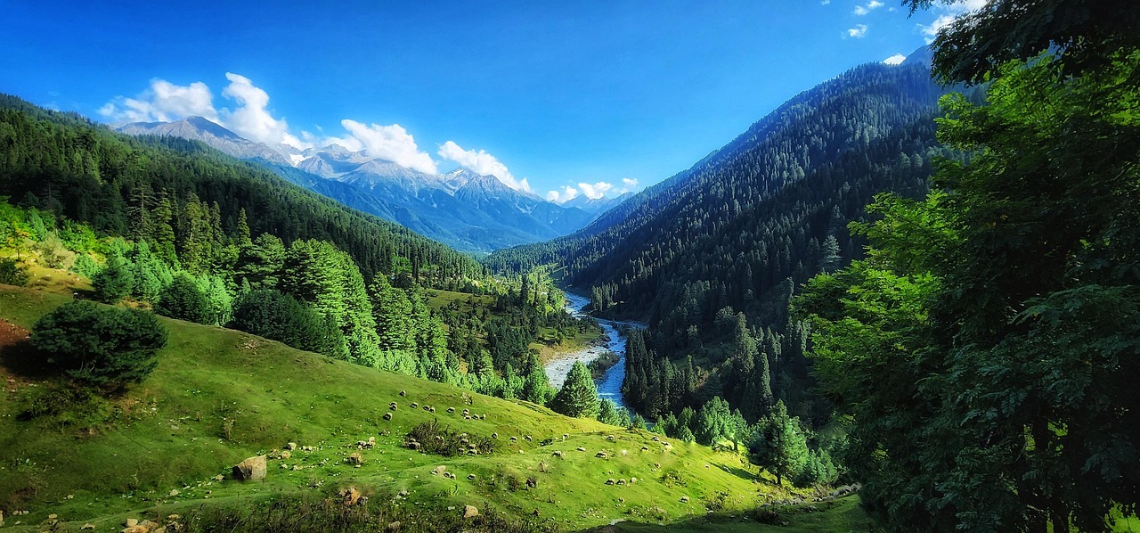
Pahalgam
Known as the 'Valley of Shepherds', Pahalgam sits at the confluence of the roaring Lidder River and Sheshnag stream in Anantnag district. Framed by thick pine forests, towering limestone cliffs, and lush meadows like Baisaran and Betaab Valley, Pahalgam serves as Kashmir's premier valley retreat and the primary mountaineering base camp for treks to the Kolahoi Glacier, Tarsar-Marsar lakes via Aru Valley, and the traditional Amarnath Yatra pilgrimage trail.
Gurez Valley
An isolated high-altitude Himalayan valley along the roaring Kishanganga River near the Line of Control, reached by crossing the wind-swept Razdan Pass (3,557m). Guarded by the monumental pyramid-shaped limestone peak of Habba Khatoon, Gurez is inhabited by the indigenous Dard-Shin community and preserves an ancient, unspoiled Himalayan rhythm with traditional wooden log homes, trout streams, and borderland trails.

Yusmarg
Meaning 'Meadow of Jesus', Yusmarg is a tranquil expanse of rolling alpine meadows in the western Pir Panjal range in Badgam district. Far quieter than Gulmarg, it is dissected by the foaming Doodhganga river and bounded by dense spruce and pine forests, with walking trails leading to the pristine Nilnag lake and the frozen alpine valley of Sang-e-Safed.

Doodhpathri
A bowl-shaped alpine meadow nestled in the Pir Panjal range in Badgam district, named 'Valley of Milk' after the frothy white rapids of the Shaliganga River as it cascades over boulder beds. The valley features lush carpet-like grasslands surrounded by pine forests, shepherd log huts, and panoramic views of snow-clad ridges.

Aharbal
Celebrated as the 'Niagara of Kashmir', Aharbal is famous for its thunderous 25-meter waterfall formed where the Veshav River plunges through a narrow granite gorge in Kulgam district. Beyond the falls, Aharbal is the vital southern Kashmir trailhead for the wilderness trek to Kungwattan alpine meadows and the sacred, high-altitude glacial lake of Kousar Nag (3,500m) in the Pir Panjal range.

Dalhousie & Dainkund Peak
Perched along the Dhauladhar ridgeline, Dalhousie is an iconic colonial-era alpine hill retreat surrounded by towering deodar forests. The trail to Dainkund Peak (2,755m)—known as the Singing Hill—offers a sweeping 360-degree panorama of the Chenab, Ravi, and Beas river basins and the snow-clad Pir Panjal range.

Khajjiar Meadow & Lake
Often celebrated as the 'Mini Switzerland of India', Khajjiar is a saucer-shaped glade nestled within dense deodar and fir forests. At its heart lies a small tranquil lake with a floating island of reed grass, framed by the 12th-century wooden temple of Khajji Nag with intricately carved serpent motifs.

Bharmour & Chaurasi Temples
Historically known as Brahmpura, Bharmour was the ancient 6th-century capital of the Chamba kingdom and is the sacred spiritual heartland of the nomadic Gaddi shepherds. The town centers around the legendary Chaurasi Temple complex—a sanctified courtyard of 84 ancient stone shrines dating back over 1,400 years, anchored by the iconic Manimahesh and Lakshana Devi temples.
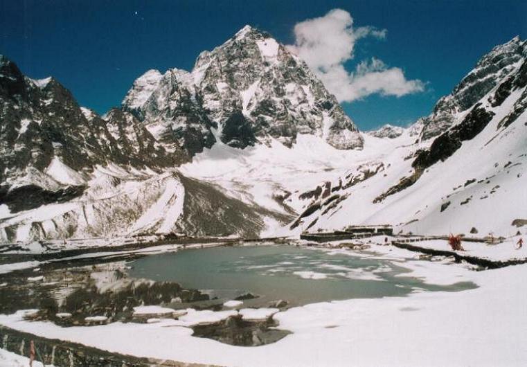
Manimahesh Kailash Lake & Trek
One of the most sacred high-altitude pilgrimage treks in the Indian Himalayas, leading to the glacial tarn of Manimahesh Lake (4,080m) resting immediately beneath the unclimbed, pyramidal summit of Manimahesh Kailash (5,653m). Undertaken annually during the sacred Janmashtami and Radhashtami fairs, the trail climbs steeply from Hadsar through steep alpine gorges, glacial moraines, and the high pasture of Gauri Kund.

Sach Pass Alpine Crossing
Notorious as one of the most perilous, thrilling, and rugged high-altitude motorable passes in the world, Sach Pass (4,414m / 14,482 ft) cuts through the formidable Pir Panjal range to connect the fertile Chamba Valley with the isolated, cliff-bound canyon of Pangi Valley. The road is carved out of sheer vertical rockfaces with thunderous glacial waterfalls cascading across the single-lane track.

Pangi Valley & Killar Gorge
Pangi Valley is the most remote, untamed, and culturally untouched alpine enclave in Himachal Pradesh, carved by the wild torrential currents of the Chandrabhaga (Chenab) River between the Pir Panjal and Zanskar mountain ranges. Centered around the rugged township of Killar, Pangi is home to the indigenous Pangwala and Bhot communities living in stone-and-timber hamlets surrounded by steep birch forests and glaciated ridges.

Triund Trek
The most popular weekend trek in Himachal Pradesh. Starting from McLeod Ganj, the trail climbs through oak and rhododendron forests to a breathtaking ridge under the sheer face of the Dhauladhar range.

Kareri Lake Trek
A glacial lake situated high in the Dhauladhar range fed by melting snow from the Minkiani Peak. Trail passes through dense pine forests along the roaring Nyund stream.

Bir Billing Adventure Hub
Ranked as one of the best paragliding sites in the world, Billing offers tandem flights landing down in the Tibetan colony of Bir with views of the snow-clad Kangra Valley.
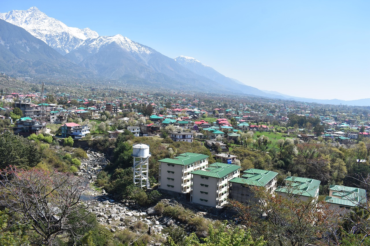
Dharamshala & McLeod Ganj
Known globally as 'Little Lhasa', McLeod Ganj sits on the upper forested slopes of the Kangra Valley beneath the towering granite cliffs of the Dhauladhar range. It is the spiritual home of the 14th Dalai Lama and the Tibetan Government-in-Exile, featuring the grand Tsuglagkhang Temple complex, the Tibetan Library of Works and Archives, St. John in the Wilderness church, and lively mountain bazaars.

Indrahar Pass Trek
The definitive high-altitude pass trek across the Dhauladhar crest. Originating from McLeod Ganj and continuing past Triund and the glacial amphitheater of Ilaqa Got, the route ascends steep boulder moraines and the famous Lahesh cave (3,500m) before tackling a grueling climb over steep stone steps and snow gullies to reach Indrahar Pass (4,342m / 14,245 ft). The pass connects Kangra with the Ravi river basin in Bharmour.

Kangra Fort & Masrur Rock Temples
Kangra Fort, perched on a precipitous sandstone spur at the confluence of the Banganga and Manjhi rivers, is the oldest surviving fort in the Himalayas and one of the oldest in India, tracing its roots to the ancient Katoch dynasty and the Mahabharata Trigarta kingdom. A short distance away lie the Masrur Rock-Cut Temples (8th century), an extraordinary monolithic temple complex carved directly out of a sandstone ridge, reflecting classical North Indian Nagara rock architecture.
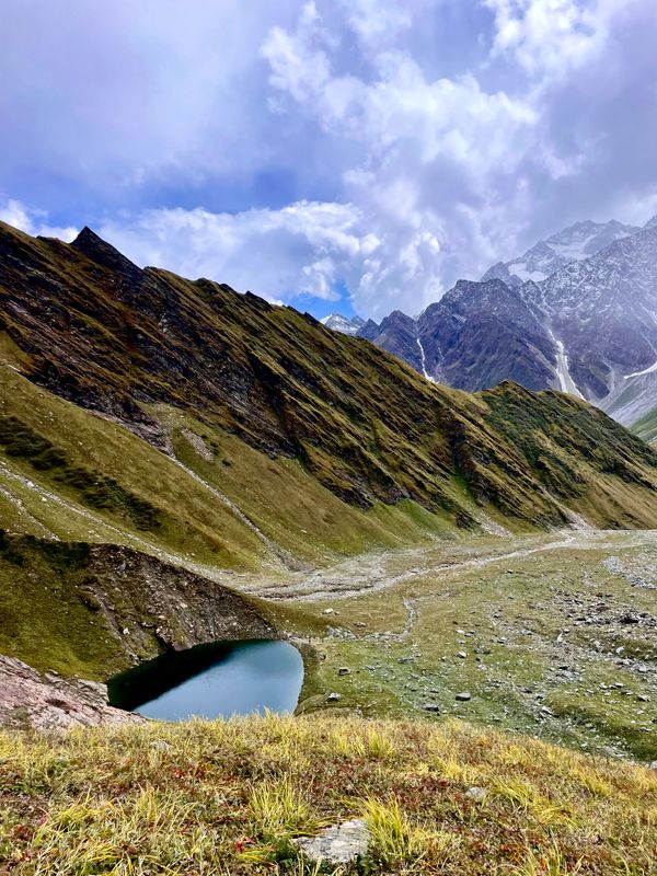
Beas Kund Trek
Beas Kund (also revered as Vyas Kund) is the sacred high-altitude glacial tarn (3,700m / 12,139 ft) from which the River Beas (ancient Vipasha) originates. Nestled directly beneath the colossal amphitheater of Friendship Peak (5,289m), Shitidhar (5,290m), Ladakhi Peak (5,345m), and the jagged pyramid of Hanuman Tibba (5,982m), it represents one of the most scenic and rewarding alpine treks in the Upper Solang Valley of Manali. The 15.5 km round-trip trail begins at the Dhundi Bridge checkpoint (2,840m) on the roaring headwaters of the Beas, climbing through ancient silver birch (Bhojpatra) and deodar woodlands to the broad glacial floodplain of Bakarthach (3,300m). Beyond the shepherd meadows, the trail ascends steeply over rugged terminal moraines, granite boulder fields, and hanging glacier ridges to reveal the serene, turquoise tarn cradled at 3,700 meters.

Lamadugh Meadow
Lamadugh is a serene meadow nestled in the dense deodar and oak forests above Manali. The trail offers a gentle ascent through shaded woodland paths, opening up to a vast alpine clearing at around 3,300 meters.
Jogni Falls Trek
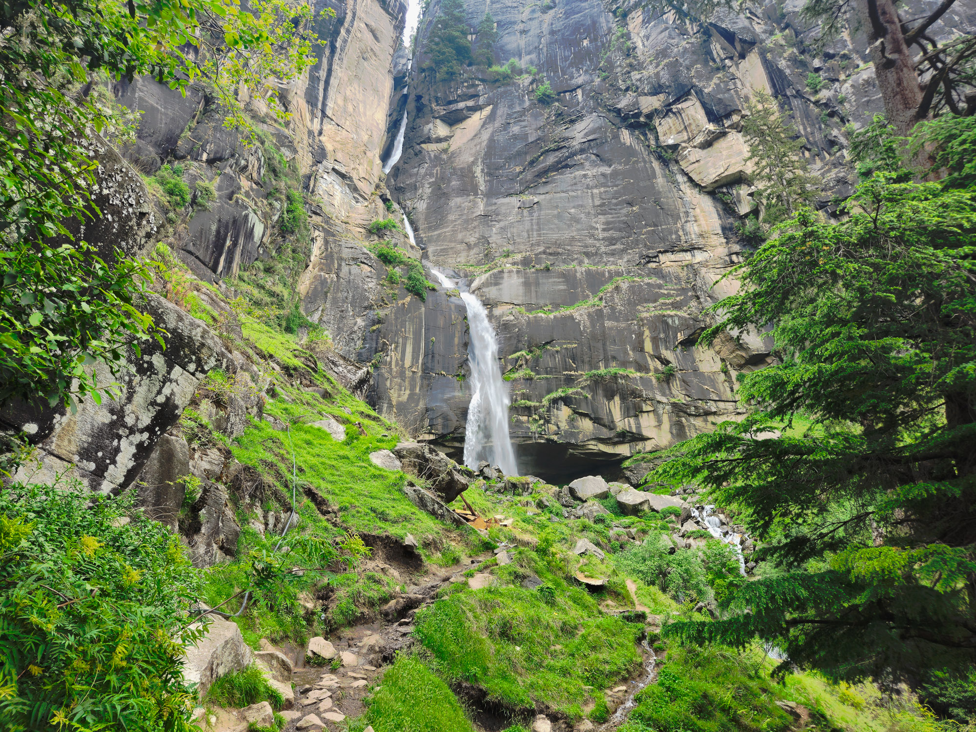
Jogni Falls (Jogini Waterfall) is a sacred 150-foot cascading cataract plunging down sheer granite cliffs in the Kullu Valley above Vashisht village, approximately 4 km from Manali. Revered by local villagers as the sacred dwelling of the village Joginis (protective female deities), the trail departs from Vashisht temple square and ascends gently through fragrant deodar woods, ancient pine forests, and terraced apple orchards. The trail features two distinct stages: the lower tiered cascades and boulder streams where glacial waters rush violently over smooth rocks, followed by a steeper dirt trail winding through tree roots and crags up to the grand upper amphitheater. Here, the full vertical plunge crashes into a crystalline plunge pool, drenching hikers in invigorating glacial spray while framing sweeping vistas of the Beas Valley and snow-draped Pir Panjal crests.
Patalsu Peak Trek
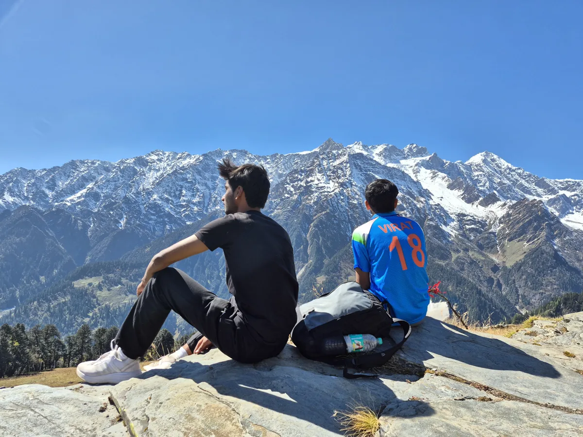
Patalsu Peak stands at 4,261 meters (13,980 ft) above Solang Valley, widely recognized as the premier beginner-friendly 4,000m trekking peak in Manali and one of the finest non-technical summits in Himachal Pradesh. The route covers 16 km round-trip from Solang Village (8 km each way) with an intense vertical gain of +1,781 meters. Celebrated as one of the best snow Manali treks during spring (May to June) when the upper ridgelines retain snowfields, and an iconic high-altitude speed hike trek in autumn for endurance athletes conquering the summit in a grueling 12–13 hour single-day push. From the summit crest, trekkers enjoy an unrestricted 360-degree panorama of Hanuman Tibba (5,982m), Friendship Peak (5,289m), Shitidhar, Ladakhi Peak, Rohtang Pass, and the boundless Dhauladhar and Pir Panjal ranges.

Hampta Pass Trek
Hampta Pass is one of the most dramatic crossovers in the Indian Himalayas — a route that transforms from lush green Kullu Valley on one side to the stark, lunar landscape of the Lahaul Valley on the other. The contrast in terrain and vegetation over just 26 km is staggering, making this one of the most visually rewarding moderate treks in Himachal Pradesh.
Bhrigu Lake Trek
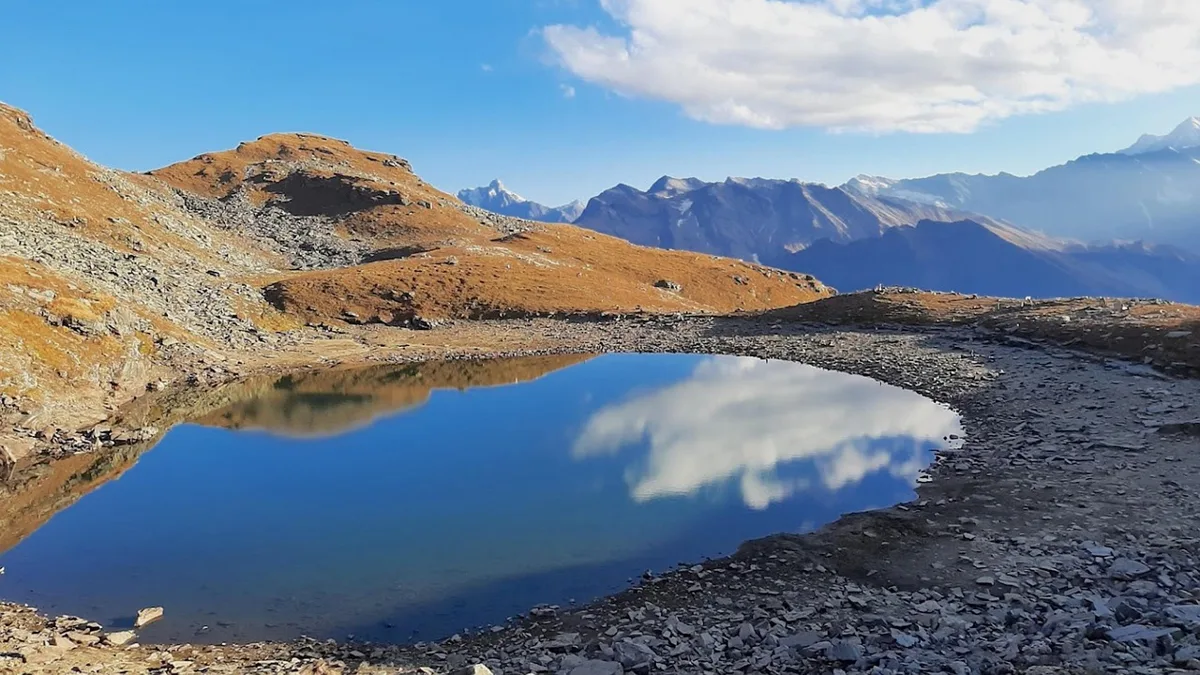
Bhrigu Lake is a stunning high-altitude lake at 4,300 meters on the edge of the Rohtang plateau. Named after the sage Bhrigu, the lake remains frozen for much of the year and is surrounded by vast rolling meadows that explode with wildflowers in early summer. It is considered one of the most accessible high-altitude alpine lakes near Manali.
Chandrakhani Pass Trek
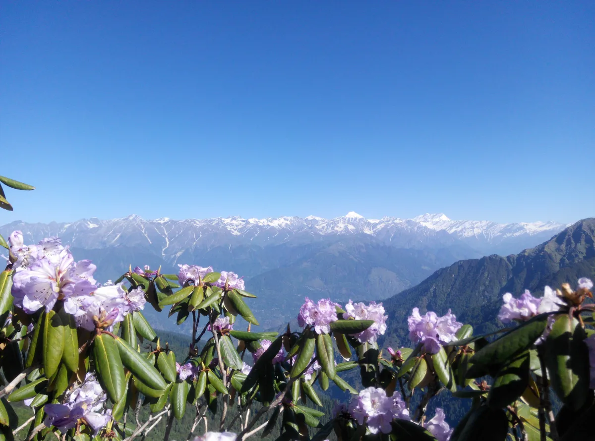
Chandrakhani Pass is a high-altitude crossing connecting the Kullu Valley to the secluded Malana village — home to one of the most unique and ancient tribal communities in the world. The route traverses stunning oak and rhododendron forests, high alpine meadows, and the dramatic pass itself at 3,660m, before descending to the legendary Malana village perched above the Malana gorge.

Friendship Peak
Friendship Peak at 5289 meters is one of the most accessible high-altitude peaks in the Himachal Himalayas, making it a popular choice for mountaineers looking to gain experience above 5000 meters. Located in the Pir Panjal range near Manali, the peak offers a perfect blend of glacier travel, snow climbing, and ridge walking without requiring advanced technical skills. The expedition typically spans 6-7 days from Manali, passing through the lush meadows of Solang Valley before ascending into the alpine zone above the treeline. The route traverses the Lady Leg glacier and involves moderate snow slopes of 35-45 degrees near the summit pyramid. On a clear summit day, climbers are rewarded with panoramic views of Hanuman Tibba, Deo Tibba, Indrasan, and the vast Pir Panjal and Greater Himalayan ranges stretching across the horizon.
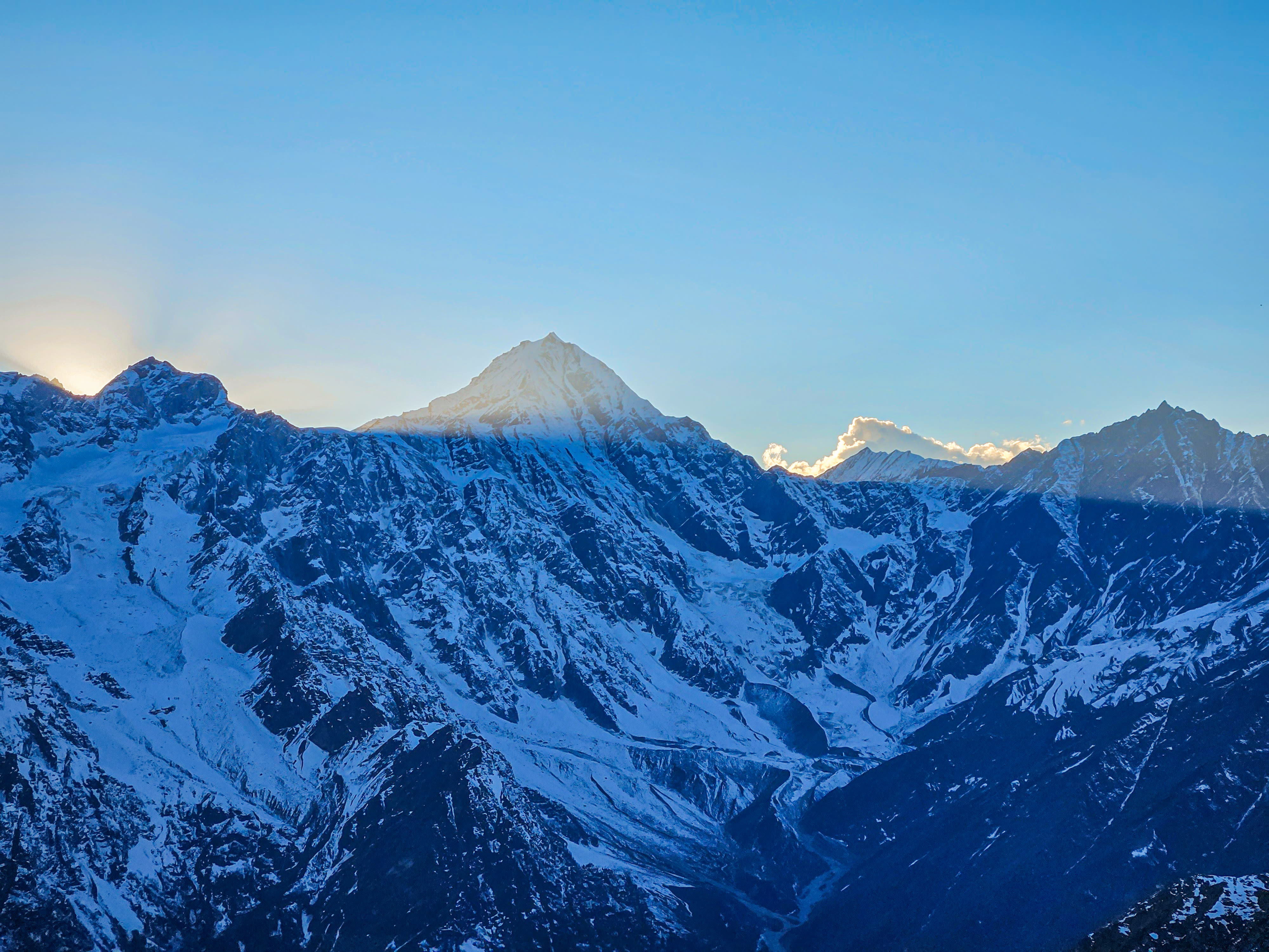
Hanuman Tibba
Hanuman Tibba at 5982 meters is the highest peak in the Dhauladhar range and a coveted objective for experienced mountaineers in the Indian Himalayas. Rising dramatically above the Solang Valley near Manali, its distinctive triangular summit is visible from much of the Kullu Valley and serves as a landmark for the entire region. The peak presents a serious mountaineering challenge with steep ice walls, exposed ridges, and unpredictable weather patterns. The standard route involves technical ice climbing sections up to 60 degrees, mixed rock and ice terrain, and requires solid rope management skills. It is classified as a difficult peak by the Indian Mountaineering Foundation. Historically significant in Indian mountaineering, Hanuman Tibba has been a training ground for expeditions to higher Himalayan peaks. The mountain demands respect — its combination of altitude, technical terrain, and rapid weather changes makes it a true test of mountaineering ability.
Deo Tibba
Deo Tibba at 6001 meters is a striking pyramidal peak that dominates the skyline south of Manali. As one of the few 6000-meter peaks accessible from the Kullu Valley, it holds a special place in Indian mountaineering as a stepping stone between intermediate and high-altitude expeditions. The peak's elegant symmetry and challenging climbing routes have attracted mountaineers since the first ascent in 1952. The standard route from the Jagatsukh Valley offers a comprehensive mountaineering experience encompassing glacier navigation, steep snow and ice climbing, and exposed ridge traversals. The peak sits at the junction of the Pir Panjal and Great Himalayan ranges, offering unobstructed views in all directions from the summit. Deo Tibba is known for its rapidly changing weather conditions, with the summit often enveloped in clouds by midday. The combination of altitude, technical difficulty, and unpredictable weather makes it a respected objective that demands thorough preparation and strong mountaineering fundamentals.

Indrasan
Indrasan at 6221 meters is one of the most formidable peaks in the Kullu-Manali region and a serious objective for experienced mountaineers. Its steep, fluted ice walls and challenging approach make it one of the harder peaks to climb in the Indian Himalayas relative to its altitude. The mountain rises sharply above the Malana Valley, presenting an imposing profile visible from multiple vantage points around Manali. First climbed in 1962 by a joint Indo-British expedition, Indrasan has maintained its reputation as a peak that demands technical excellence and strong alpine fitness. The mountain features multiple routes of varying difficulty, with the standard south ridge being the most frequently attempted. Even this route involves sustained ice climbing at high altitude and requires absolute commitment once above the midway point. The peak is flanked by its sister summit Deo Tibba to the southeast and the Duhangan Col connecting to the peaks of the Greater Himalayan range. The expedition provides an immersive high-mountain experience in one of Himachal Pradesh's most dramatic glacial landscapes.
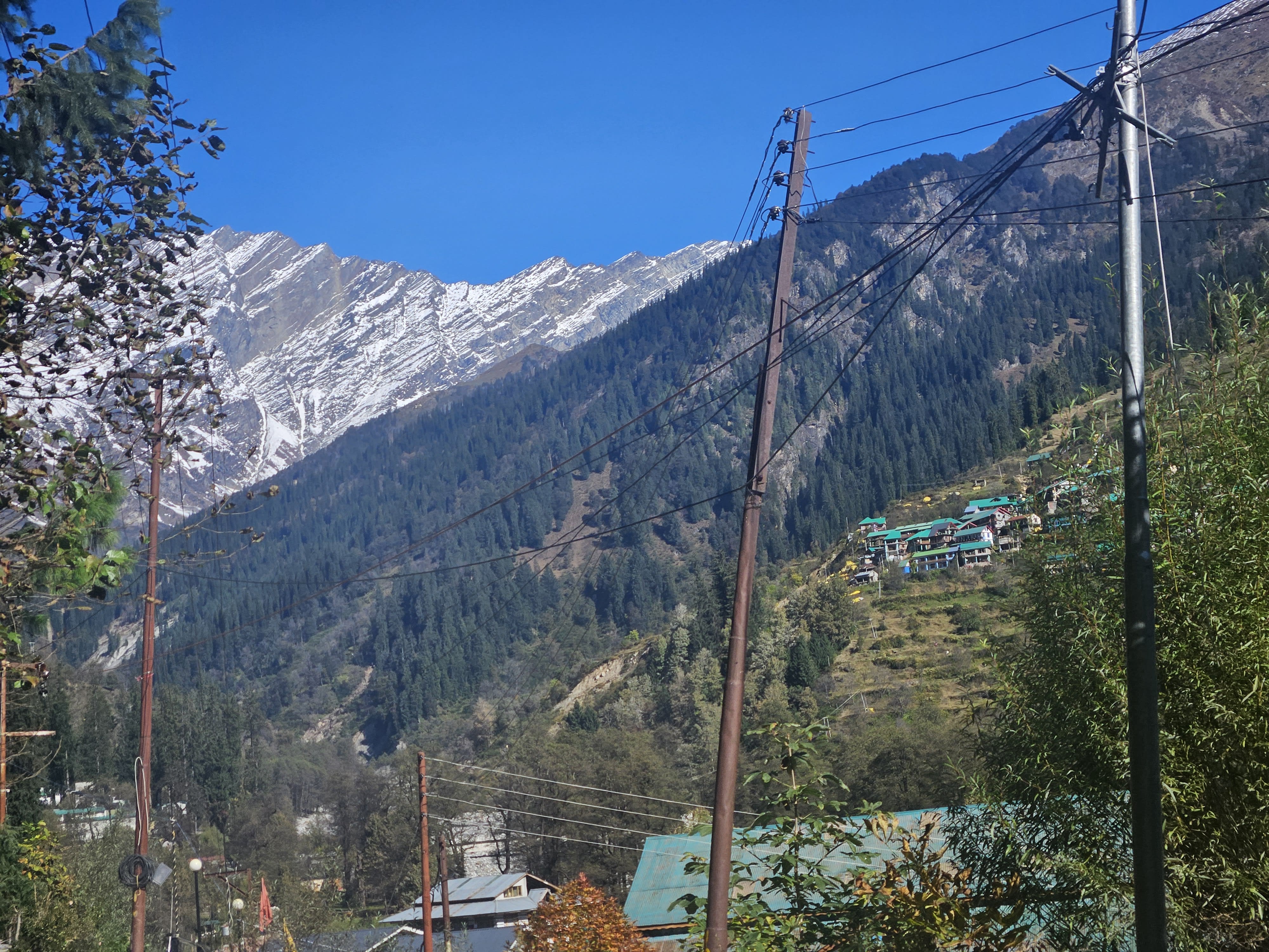
Solang Valley
Solang Valley lies 14 km northwest of Manali and serves as the gateway to the Beas Kund glacier and Patalsu Peak trails. It features skiing slopes in winter and paragliding in summer.
Sethan Village — Hampta Valley
Perched at 2,700 meters atop the Hampta ridge 12 km above Prini, Sethan is a secluded Buddhist Khampa mountain village offering sweeping 360-degree vistas of the Dhauladhar Range, Indrasan, and the Kullu Valley far below. Resettled by horse-breeding Tibetan migrants in the mid-20th century, Sethan has emerged as an internationally celebrated alpine adventure hub: a world-class bouldering destination with hundreds of virgin granite problems, India's premier winter igloo stay and ski-touring zone, and the official starting roadhead for the Hampta Pass & Chandratal crossover trek.

Tirthan Valley & GHNP
Pristine buffer zone of the UNESCO Great Himalayan National Park, famous for crystal trout streams, dense deodar forests, and peaceful trails to Jalori Pass and Serolsar Lake.
Hadimba Devi Temple
Built in 1553 CE by Maharaja Bahadur Singh, the Hadimba Devi Temple (also known as the Dhungri Temple) is an ancient four-tiered wooden pagoda dedicated to Goddess Hadimba, wife of the Pandava prince Bhima from the Mahabharata. Nestled within the colossal, sacred cedar groves of the Dhungri Van Vihar, the temple is an architectural marvel of indigenous Himalayan woodcraft, adorned with intricate carvings of deities, dancers, foliate motifs, and real ibex and stag horns mounted on outer walls.
Old Manali
Perched gracefully on a sunlit hillside across the rushing Manalsu River, Old Manali (the ancestral village of Manaligarh) is the cultural antithesis of the commercial highway town. Characterized by multi-storied slate-roofed Kath-Kuni timber-and-stone houses, heritage apple orchards, winding stone alleys, artisan silver studios, live music cafes, and the sacred Manu Maharishi Temple (the only temple in India dedicated to Sage Manu, progenitor of mankind). It is also the historic trailhead for the high alpine trek to the Lamadugh meadow plateau.

Kheerganga Hot Springs Trek
One of the most famous trekking routes in the Parvati Valley, winding through dramatic gorges, roaring waterfalls, and towering pine and oak forests from Barshaini. Kheerganga ('milky holy water') sits in an alpine meadow surrounded by glaciated peaks, renowned for its natural geothermal sulfur hot springs where trekkers soak after completing the 12 km mountain ascent.
Pin Parvati Pass Expedition
The crown jewel of Himalayan crossover expeditions, connecting the lush, rain-drenched coniferous forests of Parvati Valley in Kullu with the stark, rain-shadow cold desert of Pin Valley in Spiti. Trekkers traverse dense pine woods, raging river crossings, the sacred high tarn of Mantalai Lake (4,100m), and vast glaciated crevasse fields to summit the formidable 5,319m pass before descending into the Martian landscapes of Mudh.
Rohtang Pass
Rohtang Pass (3,978m / 13,051 ft) is the historic mountain gateway on the Pir Panjal Range connecting the Kullu Valley with the high arid valleys of Lahaul and Spiti. Meaning 'Pile of Corpses' in Tibetan due to historical storms that caught ancient caravans off guard, Rohtang offers panoramic views of glaciated peaks, hanging glaciers, and the source of the Beas River at Beas Kund.
Jalori Pass & Serolsar Lake
Jalori Pass (3,120m) is a high mountain pass connecting the inner Kullu Valley with Shimla and the Sutlej river basin. From the pass, an enchanting 5 km gentle forest trail winds through dense oak, rhododendron, and blue pine woods to Serolsar Lake—a pristine emerald body of water held sacred to Buddhi Nagin, the mythical mother of 60 snake deities.
Manali Mall Road
The central pedestrian-only promenade of Manali town, Mall Road is the social and commercial crossroads of the upper Beas Valley. Lined with wooden gables, traditional handloom emporiums selling authentic Kullu shawls, Himachali pattu coats, Tibetan handicraft stalls, Hong Kong market bazaars, and cozy sweetshops serving steaming jalebis and siddu. Directly adjacent to the mall is Van Vihar, a serene nature sanctuary of century-old deodar trees bordering the boulder-strewn waters of the Beas River.
Kullu Town
Situated on the broad banks of the Beas River, Kullu is the historic administrative capital of the Kullu Valley—historically known as Kulanthpitha ('the end of the habitable world') and Dev Bhumi ('the Valley of the Gods'). Globally celebrated for its centuries-old handloom weaving traditions, Kullu is home to major artisan clusters and cooperative factories (including the historic Bhuttico cooperative founded in 1944) producing world-famous Kullu shawls with vibrant geometric Himalayan borders. It is also home to the 17th-century Raghunath Temple at Sultanpur and Dhalpur Maidan, the sprawling open amphitheater where the legendary International Kullu Dussehra festival convenes over 300 local village deities (devi-devtas) for a week-long celebration.
Vashisht Village & Hot Springs
Perched on a steep pine-clad ridge 3 km northeast of Manali across the Beas River, Vashisht is an ancient mountain village dedicated to Maharishi Vashistha, one of the seven Saptarishis and royal guru of Lord Rama. The village features traditional wood-and-stone Himachali houses and a 4,000-year-old stone temple enclosing natural geothermal sulfur springs, channeled into public and private mineral bathing kunds prized for centuries for their therapeutic and skin-healing properties. Vashisht also serves as the traditional pedestrian trailhead for the breathtaking hike to the 160-foot cascading Jogini Waterfall.
Burwa Village
Situated 6 km north of Manali on the right bank of the Beas River, Burwa is an authentic agricultural hamlet of multi-tiered Kath-Kuni houses, stone courtyards, and deep heritage apple orchards. Far quieter than downtown Manali, Burwa offers panoramic vistas of the snow-clad Pir Panjal ridges and the Solang Valley entrance. The village is well-known among climbers for its natural granite boulder crags, proximity to Nehru Kund (a pristine natural freshwater spring where Prime Minister Nehru would drink on his mountain visits), and pastoral mountain walks through terraced fields.
Kothi Village & Gorge
Nestled 12 km north of Manali at the eastern base of the Rohtang Pass, Kothi is a dramatic high-valley village famous for its deep, narrow gorge where the Beas River plunges through a chasm of vertical granite cliffs over 100 feet deep. In historical times before motorable roads, Kothi was the mandatory caravan rest stop and basecamp for travelers and pony drivers preparing to make the treacherous ascent across the 3,978m Rohtang Pass into Lahaul. The village offers sublime views of hanging glaciers, the Solang Range, and the roaring river gorge.
Gulaba Alpine Meadow
Situated 20 km north of Manali on the winding highway to Rohtang Pass, Gulaba is a picturesque sub-alpine meadow nestled amid stands of birch, fir, and deodar trees at 3,165 meters. Named in honor of Raja Gulab Singh of Jammu & Kashmir who established his high camp here during an expedition, Gulaba is renowned as the official trailhead for the renowned Bhrigu Lake alpine trek (4,300m). During late autumn, winter, and spring when Rohtang is snowbound, Gulaba serves as the primary designated snow viewpoint where visitors experience deep snowfields, sledding, and paragliding with unobstructed views of the Solang Valley and Hanuman Tibba massif.
Marhi
Perched high above the treeline at 3,320 meters midway between Gulaba and the Rohtang summit (35 km from Manali), Marhi is an expansive alpine plateau framed by soaring sheer cliffs and cascading seasonal waterfalls. Historically a vital overnight acclimatization station and horse-caravan halt on the trans-Himalayan trade trail to Leh, Marhi today is famous for its cluster of roadside mountain dhabas serving piping hot Maggi, rajma-chawal, and ginger-lemon-honey tea. It is also an important winter snow-sports hub when the upper passes remain inaccessible.
Dhundi
Situated 8 km northwest of Solang along the roaring headwaters of the Beas River, Dhundi is a pristine alpine valley and roadhead surrounded by dense silver birch, spruce, and rhododendron forests. It is the historic trailhead for the legendary Beas Kund glacier trek (3,700m) and the primary base for technical mountaineering expeditions to Friendship Peak (5,289m), Hanuman Tibba (5,982m), and the Seven Sisters range. With the completion of the Atal Tunnel, Dhundi also marks the approach valley to the South Portal of the 9.02 km tunnel.
Bijli Mahadev Temple & Trail
Perched dramatically on the wind-scoured summit plateau of the Mathan ridge at 2,460 meters, Bijli Mahadev is one of the most sacred and mystifying temples in the Western Himalayas. The temple is famous for its 60-foot tall wooden flagstaff (dhwaja stambha) that miraculously attracts high-voltage divine lightning from thunderclouds during storms. According to ancient lore, the lightning bolt strikes the Shiva lingam inside the sanctum without causing fire, shattering the stone into fragments. The head priest then meticulously reassembles the lingam using clarified butter (sattu and makhan) until it solidifies once more into a single stone. The summit offers an unparalleled 360-degree vantage point overlooking the confluence of the Beas and Parvati Rivers, Kullu town, Bhuntar airport, and the snow-capped Pir Panjal and Great Himalayan National Park peaks.
Atal Tunnel Rohtang
Built beneath the formidable 3,978m Rohtang Pass under the Pir Panjal Range, the 9.02 km long Atal Tunnel is the world's longest single-tube highway tunnel above an elevation of 10,000 feet (3,048 m). Completed by the Border Roads Organisation (BRO) in October 2020 after two decades of complex sub-zero engineering through difficult shear zones, the horseshoe-shaped tunnel bypasses 46 km of treacherous hairpin roads and provides all-weather connectivity between Manali and the high-altitude Lahaul Valley. Entering the South Portal (3,060m) near Dhundi in the lush pine-clad Kullu Valley and emerging 10 minutes later at the North Portal (3,071m) into the dramatic, barren rocky desert canyon of Sissu is one of the most astonishing geographic transitions in the Himalayas.
Sissu (North Portal)
Situated in the high Chandra River valley just 5 km past the North Portal of Atal Tunnel, Sissu (known historically as Khwaling) is a breathtaking high-altitude oasis that has become the premier day excursion from Manali. Surrounded by weeping willows, golden poplar groves, and terraced barley fields, Sissu is globally renowned for the Palden Lhamo Dhar waterfall—a thunderous 50-meter glacial torrent dropping down a sheer dark cliff face opposite the village. Sissu Lake offers peaceful lakeside walks, ziplining, camping, and winter snow-sports.
Koksar Snow Point
Situated at 3,140 meters in a dramatic bend of the Chandra River beneath the northern slopes of Rohtang Pass, Koksar is the historic first village and customs outpost of the Lahaul Valley. Before the Atal Tunnel was built, Koksar was the legendary checkpoint where travelers emerged after surviving the perilous Rohtang crossing. Today, located just 18 km east of the tunnel's North Portal, Koksar has become one of Himachal's most thrilling snow adventure hubs, famous for holding deep snow banks well into late spring, snow-tubing, ATV snow bikes, frozen river vistas, and roadside dhabas serving authentic Himalayan mutton thukpa and hot butter tea.

Prashar Lake & Pagoda Temple
Surrounded by undulating alpine meadows and dense cedar woods, Prashar Lake is an oval high-altitude tectonic lake holding a mysterious floating circular island of reed that moves unpredictably across the seasons. On its grassy bank stands a magnificent 13th-century three-tiered pagoda temple built by Raja Ban Sen, constructed entirely of deodar wood without iron nails and dedicated to the revered sage Prashar. The surrounding ridge offers an unrestricted 360-degree panorama of the Dhauladhar, Pir Panjal, and Kinnaur mountain ranges.

Rewalsar Lake (Tso Pema)
Nestled in a natural mountain basin, Rewalsar Lake (known to Tibetans as Tso Pema or 'Lotus Lake') is one of the most sacred pilgrimage shrines in northern India, revered simultaneously by Buddhists, Hindus, and Sikhs. It is historically celebrated as the place from which Guru Padmasambhava (Guru Rinpoche) flew to Tibet to establish Vajrayana Buddhism. The lake is flanked by a colossal 138-foot bronze statue of Guru Rinpoche, multiple Tibetan monasteries, a Hindu Shiva temple, and an ancient Sikh Gurdwara.

Barot Valley & Uhl River
A hidden gem tucked within the Chauhar Valley on the banks of the roaring Uhl River, Barot was developed in the 1920s as part of the Shanan Hydroelectric Project. Surrounded by dense deodar and oak forests, Barot is renowned for its trout fishing hatchery, the historic British funicular trolley system, and serene riverside campsites. It serves as the gateway to the Nargu Wildlife Sanctuary and scenic trekking trails leading into the Chhota Bhangal valley.

Mandi Heritage & Panchvaktra Temple
Known historically as 'Chhoti Kashi' (Varanasi of the Hills), Mandi is a historic cultural city perched on the banks of the holy Beas River, boasting more than 81 ancient stone temples dedicated to Lord Shiva. The most architecturally renowned is the 16th-century Panchvaktra Temple, situated dramatically at the confluence of the Beas and Suketi rivers, featuring a five-faced stone sculpture of Lord Shiva displaying different divine cosmic aspects.
Kamrunag Lake Trek
Perched high on the Balh valley ridge, Kamrunag Lake (3,334m) is a deeply revered mountain lake dedicated to King Yaksha (Lord Kamrunag), the God of Rains. According to ancient Himalayan tradition, pilgrims who make the steep 7 km forest trek from Rohanda deposit gold coins, silver ornaments, and currency notes directly into the lake bed as offerings, which remain visible through the clear mountain water and are protected by sacred taboos.
Chandratal Lake (Moon Lake)
A pristine high-altitude crescent lake nestled in the Samudra Tapu plateau between the Pir Panjal and Great Himalayan ranges. Revered as the source of the Chandra River.
Key Gompa & Kibber
Key Monastery is a historic Tibetan Buddhist monastery perched dramatically on a conical hill above the Spiti River. Nearby Kibber is one of the highest permanently inhabited villages in the world.

Pin Bhaba Pass Trek
The most dramatic crossover trek in Himachal — starting in the lush green forests of Kinnaur's Bhaba Valley and abruptly emerging into the Martian barren landscape of Spiti's Pin Valley.
Jispa & Bhaga Riverside
Jispa is a serene village and riverside encampment on the banks of the turquoise Bhaga River in Lahaul Valley at 3,200 meters. Surrounded by towering scree mountains and willow groves, it is a favored acclimatization stop on the Manali-Leh Highway before ascending Baralacha La.
Kaza & Spiti Valley Capital
Kaza is the administrative headquarters and vibrant cultural heartbeat of the Spiti Valley, perched along the braided gravel riverbeds of the Spiti River at 3,650 meters. Divided into Old Kaza and New Kaza, it functions as the central logistical base for high-altitude expeditions, inner-line permit processing, and excursions to ancient monasteries, high villages, and passes.

Dhankar Monastery & Lake
Perched precipitously on the edge of a razor-sharp cliff 300 meters above the confluence of the Spiti and Pin rivers, Dhankar Gompa was the ancient 16th-century fortress-capital of the Spiti kingdom. From the ancient mud-and-timber monastery, a scenic 2 km uphill trail leads through wind-scoured scree to Dhankar Lake (4,140m), a high sapphire tarn framed by the jagged snow-peaks of the Manirang range.
Langza, Hikkim & Komic High Circuit
A legendary high-altitude village triumvirate perched above the Spiti canyon: Langza (4,400m), guarded by a giant golden statue of Lord Buddha facing the glaciated peak of Chau Chau Kang Nilda (6,303m) and famous for million-year-old marine Tethys Sea fossils; Hikkim (4,440m), boasting the world's highest operational post office where travelers send postcards across the globe; and Komic (4,587m), recognized as one of the world's highest permanently inhabited villages with its 14th-century Tangyud Monastery.
Chicham Bridge & Kibber Wildlife Sanctuary
Suspended at a staggering altitude of 4,150 meters, Chicham Bridge is the highest suspension bridge in Asia, spanning a terrifying 150-meter-deep vertical rocky gorge to connect the remote village of Chicham with Kibber. Surrounding this engineering marvel is the Kibber Wildlife Sanctuary, world-famous among wildlife biologists and high-altitude trackers as one of the premier global habitats for the elusive Snow Leopard, Tibetan wolf, and Himalayan ibex.

Pin Valley National Park & Mudh
Spanning the cold desert mountains of the Pin River basin, Pin Valley National Park is Himachal's only cold desert national park, protecting rare alpine flora, medicinal plants, and apex predators including the snow leopard and Tibetan wolf. The valley is steeped in the ancient Buchen sect of Tibetan Buddhism, centered around the picturesque last roadhead village of Mudh (3,800m), where colorful multi-hued mountain strata resemble painted tapestries.
Kunzum Pass
Kunzum Pass (4,551 m / 14,931 ft) is the majestic high mountain pass on the Eastern Pir Panjal and Great Himalayan Divide connecting the Lahaul Valley with the Spiti Valley. Adorned with 15 Tibetan stone chortens and fluttering lungta prayer flags, the pass houses the holy shrine of Goddess Kunzum (Kunzum Mata), where every passing vehicle completes a traditional circumambulation. The pass offers jaw-dropping vistas of the 6,000-meter Bara-Shigri glacier and Shigri peaks.

Suraj Tal & Baralacha La
Suraj Tal ('Lake of the Sun God') is the third-highest lake in India and the 21st highest in the world, sitting like a giant sapphire tarn at 4,883 meters immediately beneath the summit of Baralacha La (4,890m / 16,043 ft). Feeding the glacial currents of the Bhaga River, this high mountain lake remains partially frozen even well into July, surrounded by glaciated moraines and towering barren massifs along the legendary Manali-Leh Highway.
Keylong & Kardang Monastery
Keylong is the administrative capital of Lahaul and Spiti, situated on a terraced slope above the rushing Bhaga River amidst willow and poplar groves. Directly across the river gorge, perched dramatically against the rocky slopes of the sacred Rangcha peak, lies Kardang Monastery (900 CE)—the historical seat of the Drukpa Kagyu lineage in Lahaul, housing ancient Buddhist scriptures, exquisite thangkas, and an impressive collection of sacred musical instruments.
Kinner Kailash Parikrama
A demanding spiritual circumambulation of the 6,050 m Kinner Kailash peak, famous for its 79-foot natural rock pillar (Shivling) that changes colors throughout the day.
Chitkul & Baspa Valley
Chitkul is celebrated as the last inhabited village near the Indo-Tibet border in the picturesque Baspa Valley of Kinnaur. Sited on the banks of the roaring Baspa River amidst snow peaks, it features ancient slate-roofed Kinnauri wood-and-stone houses, potato fields, and the 500-year-old Mathi Devi temple.
Kalpa & Roghi Cliff
Kalpa is a heritage Kinnauri village perched high above the Sutlej River valley amidst sprawling apple orchards. Renowned for its unparalleled panoramic views of the sacred Kinner Kailash massif (6,050m), the village features traditional timber-and-slate temples, the Buddhist Hu-Bu-Lan-Kar gompa, and the dramatic sheer drop of Roghi Suicide Point.
Sangla Valley & Kamru Fort
Flanked by snow-capped Himalayan peaks and carpeted with lush apple and walnut orchards, Sangla Valley (the Baspa River valley) is often described as the most enchanting alpine valley in Kinnaur. Overlooking the village stands Kamru Fort, an imposing five-story tower fortress of intricately locked deodar timbers and river stone dating back thousands of years, which served as the ancient coronation seat of the rulers of the Bushahr kingdom.
Nako Lake & Ancient Gompa
Perched high above the Sutlej river gorge in Upper Kinnaur near the Indo-Tibetan border, Nako is an oasis-like high-altitude village centered around a serene, willow-fringed alpine lake at 3,662 meters. Adjacent to the lake lies the 11th-century Nako Monastery (attributed to the great translator Rinchen Zangpo), containing four ancient clay-walled prayer halls decorated with classical Western Tibetan frescoes and a revered rock impression said to be the footprint of Guru Padmasambhava.

Rupin Pass Trek (Kinnaur Terminus)
One of India's most celebrated and diverse crossover treks, starting in the pine forests of Dhaula in Uttarakhand and concluding in the idyllic Baspa Valley of Sangla in Kinnaur. The route features dramatic scenery shifts: hanging villages, three-tier glacial waterfalls, immense snow bridges, and a thrilling scramble up a steep snow gully to the summit of Rupin Pass (4,650m / 15,250 ft), with sweeping views of the Kinner Kailash range.
Reckong Peo
Reckong Peo is the administrative and commercial capital of Kinnaur District, situated on a sunny mountain terrace high above the Sutlej River. Known as the gateway for inner-line permits required for international travelers continuing towards Spiti, Peo offers uninterrupted, awe-inspiring views of the sacred Kinner Kailash massif (6,050m) and its towering companion peaks.
Garhwal Char Dham — The Sacred Himalayan Circuit
The most sacred and spiritually transformative pilgrimage circuit in the Himalayas, the Char Dham of Uttarakhand weaves through the rugged river gorges and glaciated heights of Garhwal to four revered shrines: Yamunotri (origin of River Yamuna, 3,291m), Gangotri (seat of Goddess Ganga, 3,100m), Kedarnath (highest of the 12 Jyotirlingas of Lord Shiva, 3,584m), and Badrinath (sacred abode of Lord Vishnu, 3,133m). Traditionally undertaken in a clockwise direction (Parikrama) from West to East across Garhwal's four high river valleys, this epic pilgrimage crosses four river valleys, ancient stone-and-wood Himalayan villages, thermal hot springs, high alpine bugyals, and dramatic mountain sanctuaries.

Roopkund Mystery Lake Trek
One of the most legendary high-altitude alpine treks in the Garhwal Himalayas, journeying from Lohajung through the twin rolling bugyals of Ali and Bedni to the glaciated tarn of Roopkund at 4,800m beneath the sheer rock face of Mount Trishul (7,120m). Famed for hundreds of ancient human skeletons dating to the 9th century CE preserved in the glacial ice, the trail commands sweeping vistas of Trishul, Nanda Ghunti, and Chaukhamba.
Badrinath Temple & Alaknanda Basin
One of India's four primordial Char Dham pilgrimage shrines, Badrinath is dedicated to Lord Vishnu (Badri Vishal) seated in the Padmasana meditative posture. Nestled in a high alpine valley of Chamoli Garhwal along the banks of the roaring Alaknanda River, the temple stands between the Nar and Narayana mountain ranges under the towering, glaciated pyramid of Mount Nilkantha (6,596m).
Mana — First Indian Village & Saraswati River
Designated officially as the 'First Indian Village' on the northern border, Mana sits just 3 km beyond Badrinath in the upper Alaknanda canyon. Inhabited by indigenous Bhotia (Marchha) pastoralists, Mana is steeped in epic Mahabharata lore, housing Vyas Gufa (where Sage Vyasa composed the epic), Ganesh Gufa, Bhim Pul (a colossal natural stone slab spanning the roaring Saraswati river gorge), and serving as the trailhead for Vasudhara Falls.
Joshimath (Jyotirmath) Gateway
Perched high on the steep northern slopes above the Alaknanda and Dhauliganga river confluence, Joshimath is the cardinal northern monastic seat (Uttaramnaya Jyotirmath) founded by Adi Shankaracharya in the 8th century. It houses the winter seat of Lord Badrinath at Narsimha Temple, the ancient Kalpavriksha mulberry tree (under which Shankaracharya meditated), the lower station of the Auli cable car ropeway, and serves as the strategic staging base for mountaineering expeditions into the Nanda Devi sanctuary.
Auli Alpine Meadows & Ski Slopes
Celebrated as India's premier high-altitude ski resort, Auli features undulating alpine slopes (bugyals) lined by dense conifers of oak, deodar, and silver fir. Sitting at 2,800m, Auli commands the grandest unobstructed 270-degree panorama of India's second-highest peak, Nanda Devi (7,816m), alongside Kamet, Dunagiri, Mana Parvat, and Hathi-Ghodi Parvat. In winter, international ski championships are held on its groomed powder slopes.
Govindghat Confluence & Trailhead
Sited at the roaring confluence of the Alaknanda and Bhyundar (Lakshman Ganga) rivers on NH7 between Joshimath and Badrinath, Govindghat is the indispensable roadhead and staging hub for hikers heading into the UNESCO Valley of Flowers National Park and Sikh pilgrims trekking to the glaciated shrine of Hemkund Sahib.

Ghangaria (Govinddham) Base Camp
Nestled in a sub-alpine conifer basin at the confluence of the Pushpawati and Hemganga rivers, Ghangaria (also known as Govinddham) is the solitary seasonal base settlement for expeditions into the Valley of Flowers and the climb to Hemkund Sahib. Because overnight camping is prohibited inside the national park, all trekkers stay in Ghangaria's rustic lodges, guesthouses, and Gurudwara.

Valley of Flowers National Park
A UNESCO World Heritage site and high-altitude alpine basin tucked in the upper Bhyundar valley beneath glaciated mountain walls. Discovered by mountaineer Frank S. Smythe in 1931, the valley carpets with over 520 species of wild flowering plants, including the rare Himalayan blue poppy, Brahma Kamal, cobra lily, edelweiss, and wild orchids, nourished by the rushing Pushpawati River.

Hemkund Sahib & Lokpal Lake
The world's highest Gurudwara, Hemkund Sahib is perched at an extreme altitude of 4,632 meters on the shores of the glaciated Lokpal Lake. Ringed by seven glaciated mountain peaks (Saptashringa) adorned with fluttering Nishan Sahib flags, it is revered as the spot where Guru Gobind Singh meditated in a previous incarnation as Sage Dusht Daman. Nearby stands the ancient Lakshman Temple.
Vasudhara Falls Trail
A rewarding high-altitude day hike starting from Mana village along the upper Alaknanda canyon to a vertical 122-meter (400 ft) glacial waterfall dropping from sheer granite cliff faces. Fed by melting glaciers descending from the Chaukhamba and Satopanth massifs, legend holds that the sacred waters of Vasudhara veer away from unrighteous individuals.

Kuari Pass (Curzon Trail)
Pioneered by Lord Curzon in 1905, the Kuari Pass (Curzon Trail) trek is celebrated for offering India's grandest unobstructed panoramic vistas of Nanda Devi (7,816m), Kamet, Dronagiri, Hathi-Ghodi Parvat, Neelkanth, and Trishul. Traversing ancient oak and rhododendron forests, sprawling bugyals of Gorson and Chitrakantha, the trail culminates on the wind-swept pass at 3,876 meters.
Urgam Valley & Kalpeshwar Mahadev
A lush, tranquil emerald bowl secluded between Joshimath and Helang in Chamoli district, Urgam Valley is renowned for stepped terrace fields, traditional slate-roofed Garhwali hamlets, and Kalpeshwar Mahadev. Kalpeshwar is the fifth and only Panch Kedar temple accessible year-round, where the Jata (matted hair locks) of Lord Shiva are venerated inside a natural stone cave.

Satopanth Tal Glacial Lake Trek
A sacred and strenuous high-altitude glacial expedition venturing into the untamed wilderness beyond Mana Village and Badrinath. Satopanth Tal is an emerald triangular lake of crystal-clear water sitting at 4,600m beneath the colossal glaciated amphitheater of Chaukhamba I (7,138m), Nilkantha, and Swargarohini peaks. Revered in Hindu cosmology, the three corners of the lake are the sacred meditation thrones of Brahma, Vishnu, and Maheshwar. According to the Mahabharata, the Pandavas crossed this lake to climb the stairway of Swargarohini glacier toward heaven.
Kedarnath Temple & Trail
The most revered of the twelve Jyotirlingas and the foremost among the Panch Kedar, Kedarnath is nestled at the head of the Mandakini river valley at 3,583m. Backed by the immense glaciated wall of Mount Kedarnath (6,940m) and Kedar Dome, the ancient grey-stone temple was consecrated by Adi Shankaracharya and has withstood earthquakes, avalanches, and the test of millennia.

Chopta, Tungnath & Chandrashila
A classic summit trek starting from the pristine rolling meadows of Chopta (known as the 'Mini Switzerland of Uttarakhand'). The well-paved trail climbs through thick rhododendron and scarlet oak forests to Tungnath—the highest Shiva temple in the world at 3,680 meters—and pushes 1.5 km further up a rocky ridge to Chandrashila summit (4,000m) for a stunning 360-degree vista of Nanda Devi, Trishul, and Chaukhamba.

Chandrashila Peak Summit
Towering immediately above Tungnath Temple, Chandrashila ('Moon Rock') is a prominent 4,000-meter summit in the Garhwal Himalayas. Celebrated for its legendary 360-degree panorama encompassing Nanda Devi, Trishul, Chaukhamba, Kedar Dome, Bandarpunch, and the Gangotri ranges, it is according to Hindu legend where Lord Rama meditated after defeating Ravana, and where the Moon God Chandra spent hours in deep penance.

Deoria Tal Emerald Lake & Sari
A crystalline freshwater alpine lake sitting at 2,438m surrounded by dense rhododendron and oak forests in Rudraprayag district. Famed for its mirror-like reflection of the snow-clad Chaukhamba massif on clear mornings, it is associated with the Yaksha Prashna legend from the Mahabharata. The 3 km uphill cobblestone trail starts from the picturesque village of Sari.
Madhyamaheshwar Temple & Trek
The second temple in the sacred Panch Kedar pilgrimage circuit, Madhyamaheshwar is nestled in a lush alpine meadow directly beneath the Chaukhamba massif. At this ancient stone temple, Lord Shiva's navel (nabhi) is worshipped. The trail winds from Ransi village through deep river canyons, lush oak-and-rhododendron woodlands, and remote shepherd settlements, with a stunning ridge hike up to Buda Madhyamaheshwar.
Gaurikund Thermal Springs & Trailhead
Perched along the rushing Mandakini River in Rudraprayag, Gaurikund is the sacred roadhead and trailhead for the 16 km climb to Kedarnath. Named after Goddess Parvati (Gauri) who performed rigorous spiritual penance here to win Lord Shiva as her consort, it features the historic Gauri Mata Temple and natural geothermal sulphur springs.
Triyuginarayan Akhand Dhuni Temple
A revered ancient stone temple perched on a mountain ridge near Sonprayag, Triyuginarayan is celebrated as the celestial wedding site of Lord Shiva and Goddess Parvati, witnessed by Lord Vishnu who acted as Parvati's brother. The temple is famed for its Akhand Dhuni—an eternal sacred fire in front of the sanctum that has burned continuously for three cosmic epochs (Yugas).
Rudraprayag Sangam (Alaknanda & Mandakini)
One of the sacred Panch Prayag (five holy confluences) of the Garhwal Himalayas, Rudraprayag marks the dramatic confluence where the roaring emerald waters of the Alaknanda River meet the torrential rapids of the Mandakini River. Named after Lord Shiva (Rudra) who performed the celestial Tandava here, the town serves as the primary gateway bifurcation heading north toward Kedarnath and northeast toward Badrinath.
Gangotri Temple & Bhagirathi Canyon
The venerated seat of Goddess Ganga and one of the four cardinal Char Dham pilgrimage shrines. Perched at 3,100m on the granite banks of the roaring Bhagirathi River in Uttarkashi district, the white marble temple was constructed in the 18th century by Gorkha commander Amar Singh Thapa. Key sacred landmarks include the Bhagirath Shila (the granite slab where King Bhagiratha meditated to bring Ganga to Earth), the natural submerged rock Shivalinga visible in winter, the thunderous granite gorge of Surya Kund waterfall, and the ancient Pandava Gufa.
Uttarkashi Town & Kashi Vishwanath
Often called 'Varanasi of the North', Uttarkashi is the cultural, spiritual, and mountaineering capital of Garhwal nestled along the Bhagirathi River. Revered for the ancient Kashi Vishwanath Temple featuring the legendary 26-foot Shakti Trishul forged of divine copper-iron alloy that vibrates when touched by a single finger. The town is also the home of India's premier mountaineering academy, the Nehru Institute of Mountaineering (NIM).
Barkot Gateway
Barkot is a scenic mountain town in Uttarkashi district situated along the banks of the Yamuna River. Surrounded by apple orchards and offering views of the Bandarpoonch peak, it serves as the primary staging hub and road base for pilgrims and trekkers journeying to Yamunotri.
Gaumukh Tapovan Trek
One of the most awe-inspiring glacier expeditions on Earth, the Gaumukh Tapovan trek journeys along the holy Bhagirathi River to Gaumukh—the snout of the 30-km Gangotri Glacier and the true origin of River Ganga. Ascending the steep terminal moraine leads to Tapovan (4,463m), a high-altitude alpine meadow where sadhus meditate directly beneath the sheer 2,000-meter vertical granite spire of Mount Shivling (6,543m) and the Bhagirathi peaks.
Dayara Bugyal Trek
Considered by many the most expansive and visually stunning high-altitude alpine meadow (bugyal) in India, Dayara Bugyal spans over 28 square kilometers of rolling grasslands at 3,750m in Uttarkashi. Flanked by ancient oak and maple forests, it opens into an undulating sea of green (or snow in winter) with grand panoramic views of Bandarpoonch (6,316m), Black Peak (Kalanag), Draupadi Ka Danda, and the Gangotri range.
Kedarkantha Summit Trek
Widely regarded as India's quintessential winter snow trek, Kedarkantha features a picture-perfect pyramid summit rising to 3,800m in the Govind Pashu Vihar National Park. Starting from the charming wooden hamlet of Sankri, the trail winds past pine forests and frozen Juda Ka Talab lake to culminate in a dramatic pre-dawn summit push to a stone trishul shrine with a 360-degree sunrise panorama of thirteen Himalayan ranges.
Har Ki Dun (Valley of Gods)
A cradle-shaped hanging amphitheatre valley tucked inside the Govind Pashu Vihar National Park in western Garhwal. Steeped in Mahabharata mythology as the pathway taken by the Pandavas ascending to heaven, Har Ki Dun winds alongside the rushing Supin River through ancient wooden settlements (Osla, Gangaad), dense walnut and pine forests, and opens beneath the colossal glaciated face of Swargarohini (6,252m) and Jaundhar Glacier.

Harsil Valley & Dharali
A tranquil, unspoiled Himalayan hamlet nestled along the rushing Bhagirathi River 25 km before Gangotri, surrounded by dense deodar forests, traditional wooden footbridges, and apple orchards pioneered by the British soldier 'Pahari Wilson' in the 19th century. Dharali and the sacred village of Mukhba (the winter abode of Goddess Ganga) lie directly across the valley floor.
Yamunotri Temple & Janki Chatti Trail
The westernmost of the Char Dham pilgrimage shrines, Yamunotri sits perched at 3,291m in a narrow mountain cleft at the foot of Kalind Parvat. Dedicated to Goddess Yamuna, the temple features the boiling geothermal springs of Surya Kund (where pilgrims boil rice in cotton bags as prasad) and the sacred Divya Shila rock pillar, with the true glacier source at Champasar Glacier 1 km higher.
Dodital Lake & Darwa Pass Trek
A serene freshwater alpine lake enveloped in dense oak, pine, and rhododendron forests in Uttarkashi district, revered as the legendary birthplace of Lord Ganesha (Dodi Tal). Famed for its rare Himalayan Golden Trout, the trail continues past the lake to the wind-whipped crest of Darwa Pass (4,150m), opening breathtaking panoramic vistas of the Bandarpoonch and Swargarohini mountain massifs.
Dhari Devi Temple — Guardian Deity of Uttarakhand
Perched dramatically on a raised concrete pillar over the sacred rushing waters of the Alaknanda River at Kalyasaur (between Srinagar and Rudraprayag on NH7), Dhari Devi is revered as the guardian protector of the Char Dham and the presiding deity of Uttarakhand. According to ancient lore, the idol of Goddess Kali changes appearance thrice daily—from a maiden in the morning, to a fierce warrior woman in the afternoon, and an elderly matriarch by dusk. It is deeply believed that no pilgrimage into the high shrines of Kedarnath and Badrinath is complete without stopping here to seek Maa Dhari Devi's blessings and protection for safe passage across the mountain roads.
Lansdowne Hill Station
A quiet, unspoiled cantonment town established in 1887 and named after Lord Lansdowne (Viceroy of India). Perched at 1,706m amidst thick blue pine and oak forests, it serves as the regimental headquarters of the renowned Garhwal Rifles. Famed for its peaceful, uncommercialized colonial ambiance, heritage stone churches, Bhulla Tal lake, and Tip-in-Top viewpoint.
Khirsu Mountain Village
A tranquil hamlet nestled amidst dense deodar, oak, and apple orchards 15 km from Pauri town, offering one of the widest panoramic vistas in Garhwal with over 300 snow-capped Himalayan peaks visible on clear autumn and winter horizons.
Tarkeshwar Mahadev Deodar Sanctuary
An ancient Shiva shrine secluded in a thick virgin forest of towering deodars and blue pines near Lansdowne in Pauri Garhwal. Believed to be the place where the demon Tarakasura meditated on Lord Shiva to attain invincibility, the temple is adorned with thousands of brass bells offered by devotees whose prayers were answered.
Tehri Lake & Adventure Hub
Created by the colossal Tehri Dam—one of the world's highest rock-and-earth fill embankment dams (260.5m) impounding the Bhagirathi and Bhilangna rivers—Tehri Lake is a sprawling 42-square-kilometer turquoise reservoir. It has emerged as Uttarakhand's premier water adventure hub, offering jet skiing, speed boating, banana boat rides, wakeboarding, parasailing, and luxury floating houseboats.
Kanatal & Surkanda Devi Ridge
A tranquil mountain ridge perched on the Mussoorie-Chamba highway at 2,590m, Kanatal is famous for cool mountain breezes, apple orchards, and pine forests. Overlooking the ridge at 2,756m stands the sacred hill temple of Surkanda Devi—a prominent Shakti Peetha where Goddess Sati's head fell, accessible by a 2 km uphill walk or ropeway offering 360-degree views of the Garhwal peaks.
Devprayag (Ganga Confluence)
The most sacred and visually dramatic of the Panch Prayag, Devprayag is where the churning turquoise rapids of the Bhagirathi River merge with the calm, deep-green waters of the Alaknanda River to officially form the holy River Ganga. Sited in Tehri Garhwal, the town features the 10,000-year-old Raghunathji stone temple (built of massive uncemented stones) and sacred bathing ghats.
Mussoorie & George Everest Ridge
Known as the 'Queen of the Hills', Mussoorie perches on a scenic horseshoe ridge at 2,000m overlooking the twinkling lights of the Doon Valley and the snow-capped Garhwal peaks. The historic estate and peak of Sir George Everest (Surveyor General of India who mapped Mount Everest) offers a popular 360-degree ridge day hike connecting into the Benog Wildlife Sanctuary and Hathipaon.
Chakrata & Tiger Falls
A secluded cantonment town nestled in the Jaunsar-Bawar tribal region of Dehradun district, surrounded by thick deodar, oak, and rhododendron forests. Free from commercial tourist crowds, Chakrata is famous for Chilmiri Neck (a panoramic sunset plateau) and Tiger Falls—one of Uttarakhand's highest direct waterfalls dropping 95 meters into an emerald forest pool.
Rishikesh & Shivpuri Adventure Corridor
Hailed worldwide as the 'Yoga Capital of the World' and India's adventure capital, Rishikesh sits where the holy River Ganga emerges from the Himalayan foothills into the plains. The 20 km corridor stretching upstream through Shivpuri, Marine Drive, and Kaudiyala is world-renowned for Grade III and IV white-water rafting rapids (The Wall, Roller Coaster, Golf Course), bungee jumping, cliff diving, and evening Ganga aarti at Triveni Ghat and Parmarth Niketan.
Kankhal Heritage & Daksh Prajapati Temple
An ancient sacred town and heritage neighborhood located 4 km south of Har Ki Pauri. Kankhal is celebrated in Hindu puranas as the capital of King Daksha Prajapati, father of Goddess Sati. The grand Daksh Mahadev Temple complex marks the exact sacrificial fire altar (Yajna Kund) where Sati immolated herself, leading to Shiva's devastating Tandava dance. Also houses the serene Ma Anandamayi Ashram.
Mansa Devi & Chandi Devi Siddhpeeths
The twin guardian hilltop Siddhpeeths flanking Haridwar across the Ganges. Goddess Mansa Devi sits atop Bilwa Parvat (reachable by scenic cable car / ropeway or walking path), while Goddess Chandi Devi crowns the Neel Parvat peak across the river. Together with Maya Devi, they form the sacred Siddhpeeth triangle protecting the holy city.
Har Ki Pauri & Sacred Ganga Ghats
The most famous and revered ghat on the banks of the holy Ganges where the sacred river enters the plains of northern India from the Himalayas. Believed to bear the footprint (Pauri) of Lord Vishnu, Har Ki Pauri is the epic epicenter of the world-famous evening Ganga Aarti, where thousands of floating leaf diyas and bronze lamps illuminate the shimmering turquoise river amidst reverberating Vedic chants.
Rajaji National Park Foothills
Sprawling across 820 square kilometers of the Shivalik foothills and Terai sal forests spanning Haridwar, Dehradun, and Pauri Garhwal districts, Rajaji National Park is a prominent Project Tiger and Project Elephant reserve. Nourished by the Ganga and Song rivers, it is home to over 500 Asian elephants, Royal Bengal tigers, leopards, sloth bears, and more than 400 species of resident and migratory birds.
Darma Valley & Rung Borderlands
A remote, breathtaking high-altitude valley carved by the Dhauliganga River in eastern Kumaon along the borders of Tibet and Nepal. Home to the indigenous Rung community, Darma Valley boasts raw alpine meadows, dramatic glaciers spilling directly toward traditional stone villages like Dantu, Dugtu, and Go, and close-up views of the east face of the Panchachuli range.
Panchachuli Base Camp Trek
A thrilling trek leading to the very foot of the Meola Glacier and the legendary Five Churis (cooking hearths) of the Pandavas—the Panchachuli massif (6,904m). Starting from Sobla or Dantu in Darma Valley, the trail hugs the raging glacier torrents through birch and rhododendron forests onto high moraine plateaus directly beneath the colossal peaks.
Nanda Devi East Base Camp Trek
The premier expedition trek of Kumaon, following the ancient trans-Himalayan trade corridor through the Gori Ganga gorge from Munsiyari to the foot of Mount Nanda Devi East (7,434m). Traversing desolate ruins of salt-trade villages like Martoli and Rilkot, the trail climbs onto the vast glaciated high meadow of Panchu, offering an intimidating, up-close view of the near-vertical eastern face of India's second-highest mountain.
Munsiyari & Panchachuli Base Camp
Perched on a high ridge in upper Kumaon overlooking the roaring Goriganga River valley, Munsiyari ('Place with Snow') is the gateway to the glaciated borderlands. The town is dominated by the legendary five peaks of Panchachuli ('Five Chintamani hearths'), where the Pandavas cooked their last meal before ascending to heaven. The trek leads along the river into the remote Darma valley to the foot of the Panchachuli glacier.
Khaliya Top Ridge Hike
A rewarding high-altitude day hike starting from Balati Bend near Munsiyari, climbing through dense rhododendron, oak, and alpine birch forests to an expansive alpine meadow ridge at 3,500m. Khaliya Top offers the closest and most dramatic 360-degree panorama of the Panchachuli range, Mount Nanda Devi, Hardeol, Rajrambha, and into western Nepal's Api and Nampa massifs.
Milam Glacier Expedition
One of the most storied trans-Himalayan trail expeditions, the Milam Glacier trek follows the ancient Indo-Tibetan trade route up the rugged Johar Valley along the roaring Goriganga River. Passing through ancient, abandoned stone villages of the Shauka community (Martoli, Burfu, Milam), the trek culminates at the snout of the 37-km long Milam Glacier beneath the colossal peaks of Trishuli (7,074m) and Hardeol (7,151m).
Adi Kailash & Om Parvat Sacred Circuit
One of the most sacred pilgrimage expeditions in high Asia, traversing the remote Vyas and Darma valleys near the Indo-Tibetan border in northeastern Pithoragarh. The journey visits Adi Kailash (revered as Chhota Kailash) towering above the sacred emerald waters of Parvati Sarovar, and Om Parvat (6,191m)—a miraculous mountain where natural snow deposits carve the sacred Hindu syllable 'OM' across black granite.
Chaukori Tea Gardens & Western Views
Perched high on a bowl-shaped ridge in upper Pithoragarh, Chaukori is renowned for emerald British-era tea plantations, fragrant deodar and pine groves, and an unobstructed panoramic balcony view of the central Himalayan crest: Nanda Devi, Nanda Kot, and the Panchachuli peaks.
Patal Bhuvaneshwar Subterranean Cave Shrine
An extraordinary 160-meter long limestone cave shrine plunged 90 feet beneath the earth near Gangolihat in Pithoragarh district. Described in the ancient Skanda Purana, the cave features dramatic stalactite and stalagmite formations worshipped as representations of 33 crore Hindu deities, Sheshnag, the matted hair of Lord Shiva, and the wish-granting Kalpavriksha tree.
Pindari Glacier Trek
One of the oldest and most celebrated glacier treks in the Indian Himalayas, Pindari Glacier has captivated mountain explorers for over a century. Walking through the pristine Pindar River gorge from the roadhead at Kharkiya, the trail ascends past traditional wooden villages (Lohar Khet, Khati) and dense rhododendron forests to Zero Point (3,860m), directly facing the vast icefall of Pindari Glacier wedged between Mount Nanda Devi and Nanda Kot.
Kausani Panoramic Himalayan Balcony
Dubbed the 'Switzerland of India' by Mahatma Gandhi who stayed here in 1929 and composed his treatise on Anasakti Yoga, Kausani perches on a high pine ridge in Bageshwar district. It commands a world-famous, 300-kilometer uninterrupted panoramic vista of Himalayan peaks including Mount Trishul, Nanda Devi, and Panchachuli, complemented by tea estates and peaceful ashrams.
Baijnath Temple Complex & Gomti Basin
Sited on the left bank of the Gomti River 16 km from Kausani in Bageshwar district, Baijnath is a magnificent 12th-century stone temple complex built by the Katyuri kings who ruled Kumaon. Dedicated to Lord Shiva (Vaidyanatha), the main sanctum houses an exquisitely detailed, unblemished black stone idol of Goddess Parvati.
Kafni Glacier Trek
Branching east from the Pindari trail at Dwali, the Kafni Glacier trek leads into a wilder, broader, and far less frequented alpine valley beneath the glaciated foot of Mount Nanda Kot (6,860m). The route crosses vibrant alpine bugyals carpeted in wild anemones and gentians to reach the lateral moraine of Kafni Glacier at 3,860m.
Binsar Wildlife Sanctuary & Zero Point
Perched atop the Jhandi Dhar hills 30 km north of Almora, Binsar was the historic summer capital of the Chand kings of Kumaon. Today a protected sanctuary spanning 47 square kilometers of dense oak, rhododendron, and pine forests, Binsar is a world-class birdwatching reserve with over 200 avian species. The short forest hike to Zero Point commands an intimate 300-km panoramic vista of Kedarnath, Shivling, Trishul, and Nanda Devi.
Jageshwar Dham Temple Complex
Nestled in a serene, narrow mountain valley shaded by colossal deodar trees 36 km northeast of Almora, Jageshwar Dham is a cluster of over 124 stone temples dating from the 7th to 14th centuries (Katyuri and Chand dynasties). Believed to be the site of the first of the twelve Jyotirlingas (Nagesh Jyotirlinga), it is one of the most venerable Shaivite pilgrimage sites in the Himalayas.
Ranikhet Chaubatia Pine Meadows
The 'Queen's Meadow', Ranikhet is a colonial hill station and headquarters of the Indian Army's Kumaon Regiment, set amongst dense pine, oak, and deodar forests in Almora district. It features the sprawling Chaubatia apple and peach orchards, the 9-hole Upat Golf Course (one of India's highest), and sweeping views of western Himalayan peaks.
Kasar Devi Ridge & Magnetosphere
Perched on a craggy ridge 8 km north of Almora, Kasar Devi is an ancient 2nd-century rock shrine celebrated for an extraordinary geomagnetic anomaly. Situated under the Van Allen radiation belt (a rare electromagnetic field shared with Stonehenge and Machu Picchu), Kasar Devi has been a spiritual and bohemian magnet, attracting Swami Vivekananda, Timothy Leary, Bob Dylan, and DH Lawrence to what became famous as 'Crank's Ridge'.
Nainital Lake & Naina Peak
The jewel of Kumaon's lake district, Nainital sits in an eye-shaped valley encircling the emerald waters of Naini Lake. Flanked by colonial promenades and the sacred Naina Devi temple (a prominent Shakti Peetha), the town's highest summit—Naina Peak (Cheena Peak at 2,615m)—offers a rewarding 6 km day-hike through rhododendron forests with sweeping views of the northern snow peaks and the lake basin below.
Mukteshwar Ridge & Chauli Ki Jali
A peaceful hilltop destination situated 50 km from Nainital at 2,171m, surrounded by fruit orchards and coniferous forests. Famous for the 350-year-old Mukteshwar Dham Shiva temple atop the highest point, and the adjacent overhanging cliffs of Chauli Ki Jali—a dramatic rocky precipice popular for rock climbing, rappelling, and unobstructed vistas of Nanda Devi.
Pangot & Kilbury Bird Sanctuary
Located just 15 km beyond Nainital through dense oak, pine, and rhododendron forests, Pangot and Kilbury is an internationally acclaimed birdwatching sanctuary. Home to over 580 recorded bird species, it is a haven for observing rare Himalayan avian fauna, including cheer pheasants, koklass pheasants, white-throated laughingthrushes, and lammergeiers.
Jim Corbett National Park Foothills
Established in 1936 as India's first national park (Hailey National Park), Jim Corbett National Park sprawls across the forested Shivalik foothills of Nainital and Pauri Garhwal along the Ramganga River. Famous for the highest tiger density among India's reserves, wild elephant herds, dense sal forests, and the iconic Dhikala grassland zone.
Abbott Mount & Lohaghat
A serene colonial mountain hamlet established in 1914 by British businessman Harold Abbott, Abbott Mount features 13 heritage stone cottages scattered across an oak-and-pine ridge with sweeping vistas of eastern Himalayan snow peaks. Nearby Lohaghat on the banks of the Lohawati River is renowned for pine forests, walnut groves, and the ancient hilltop fort of Banasur.
Advaita Ashrama Mayawati
Situated 9 km from Lohaghat surrounded by deep pine, oak, and deodar forests, Advaita Ashrama at Mayawati was founded in 1899 by Captain Sevier and his wife under the guidance of Swami Vivekananda. Dedicated strictly to the non-dualistic Advaita Vedanta philosophy, no external images, idols, or ceremonial rituals are permitted here—only silent meditation and self-realization amidst nature.
Nanakmatta Sahib & Reservoir Wetland
A revered historic Sikh pilgrimage sanctuary located along the Deoha River in the fertile Terai plains of Udham Singh Nagar. Associated with the visits of Guru Nanak Dev in 1514 and Guru Hargobind, it houses the sacred drying Pipal tree (Panja Sahib), a magnificent marble Gurudwara complex, and the adjacent sprawling Nanakmatta Reservoir dam, which serves as an important winter wetland habitat for migratory waterfowl.
Markha Valley Trek
Ladakh's most famous trek traversing Hemis National Park, ancient mud-brick villages, waist-deep river crossings, and ascending to Kongmaru La for views of Kang Yatse.
Pangong Tso Lake
A world-famous 134 km long endorheic lake extending from India to Tibet, known for shifting shades of cobalt, cyan, and emerald green against barren mountains.
Khardung La Pass
The world-renowned gateway between the Indus Valley and Nubra, draped with thousands of fluttering Tibetan prayer flags.
Leh Heritage Town
Leh is the ancient capital of the Himalayan kingdom of Ladakh. Dominated by the 17th-century nine-story Leh Palace and the hilltop Shanti Stupa, its labyrinthine old town bazaars, ancient mud-brick Tibetan buildings, and stupas sit beneath the towering snowbound crests of the Stok range.
Gurudwara Pathar Sahib
Perched at 3,500m along the Srinagar-Leh highway 25 km west of Leh, Gurudwara Pathar Sahib is a sacred Sikh shrine venerating Guru Nanak Dev Ji miraculous visit in 1517. It houses the sacred unmovable boulder bearing the imprint of Guru Nanak back, preserved and lovingly maintained by the Indian Army.
Thiksey Monastery
A twelve-storey monastery complex resembling the Potala Palace of Lhasa, housing a magnificent two-storey statue of Maitreya Buddha.
Suru Valley & Nun Kun Massif
One of the most dramatic valleys in Ladakh, with green willow groves along the Suru River set against the sheer vertical faces of Mount Nun (7,135 m) and Kun (7,077 m).
Mulbekh Rock-Carved Maitreya
A giant 9-meter rock sculpture of Maitreya Buddha carved directly into a limestone cliff face dating back to the 8th century Kushan-Tibetan era on the Srinagar-Leh highway.
Hunder Sand Dunes & Bactrian Camels
A surreal high-altitude cold desert where rolling white sand dunes sit between snowy mountain ranges, home to rare double-humped Bactrian camels from the Silk Road.
Diskit Monastery & 32m Buddha
The oldest and largest monastery in the Nubra Valley, crowned by a majestic 32-meter statue of Jampa (Maitreya) Buddha facing down the Shyok River toward Pakistan.
Turtuk Balti Village
The northernmost frontier settlement in India, opened to travelers in 2010. Renowned for its unique Balti culture, wooden irrigation canals, and lush apricot orchards.
Mushkoh Valley Wildflower Trail
A picturesque, uncommercialized valley near Drass that blooms with wild alpine flora, tulip fields, and crystal mountain streams throughout the summer.
Drass & Kargil War Memorial
Located along the highway at the base of the Tololing ridge, honoring the courage of Indian soldiers with mountain viewpoints overlooking Tiger Hill and Batra Top.
Chadar Trek (Frozen River Expedition)
One of the world's most unique winter wilderness treks — walking on a frozen sheet of ice (the Chadar) over the roaring Zanskar River through deep vertical gorges in sub-zero cold.
Phuktal Gompa (Cave Monastery)
An extraordinary 12th-century monastery built like a honeycomb around a natural cave opening high above the turquoise Tsarap Chu river gorge.
Padum & Karsha Gompa
The administrative capital of Zanskar, dominated by the whitewashed tiers of Karsha Monastery and surrounded by glaciated peaks.
Visualize Topography in 3D WebGL
Launch our interactive satellite terrain engine to inspect ridgeline gradients, high pass corridors, and glacial watersheds across all four territories.