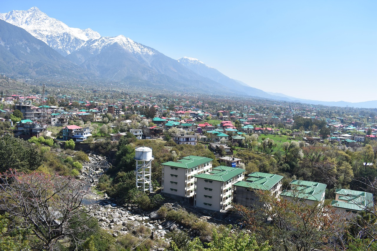
Dharamshala & McLeod Ganj
Known globally as 'Little Lhasa', McLeod Ganj sits on the upper forested slopes of the Kangra Valley beneath the towering granite cliffs of the Dhauladhar range. It is the spiritual home of the 14th Dalai Lama and the Tibetan Government-in-Exile, featuring the grand Tsuglagkhang Temple complex, the Tibetan Library of Works and Archives, St. John in the Wilderness church, and lively mountain bazaars.
About Dharamshala & McLeod Ganj
Known globally as 'Little Lhasa', McLeod Ganj sits on the upper forested slopes of the Kangra Valley beneath the towering granite cliffs of the Dhauladhar range. It is the spiritual home of the 14th Dalai Lama and the Tibetan Government-in-Exile, featuring the grand Tsuglagkhang Temple complex, the Tibetan Library of Works and Archives, St. John in the Wilderness church, and lively mountain bazaars.
“Listening to Tibetan monks enthusiastically debating Buddhist philosophy in the Tsuglagkhang courtyard while prayer wheels spin against mountain mists.”
Key Place Highlights & Field Notes
Walk the peaceful circumambulation path (Kora) around the Dalai Lama's temple for panoramic Kangra valley views.
Serves as the primary springboard for Triund, Kareri Lake, and Indrahar Pass treks.
Reaching Dharamshala & McLeod Ganj
Practical approach guidelines, road accessibility, and high-altitude meteorological conditions in Kangra, Himachal Pradesh.
Roadhead & Approach Transit
Accessible via the road network of Kangra, connecting through major Himalayan arteries. Local taxi unions and state transport operate seasonal schedules depending on weather clearance.
Trail & Walking Requirement
A modest walk or well-marked trail leads to the primary destination. Sturdy footwear is recommended on rocky steps and loose gravel surfaces.
Seasonal Window & Snow Clearance
Best visited during Year-round (Best: March–June, Sep–Nov). High-altitude sections may experience heavy winter snowfall, temporarily closing vehicle access between December and March.
Mountain weather can change rapidly. Check local administration updates and avalanche warnings during active precipitation.
Seasons & Atmospheric Cycles
Primary Window: Year-round (Best: March–June, Sep–Nov)How weather, road accessibility, light quality, and landscape character shift across the four Himalayan cycles at Dharamshala & McLeod Ganj.
Spring
March – MayCarry layered fleece and windproofs; afternoon showers common during seasonal transitions.
Summer
June – AugustMonsoon rains impact lower foothills (July–Aug); check highway landslide bulletins.
Autumn
September – NovemberTemperatures drop sharply after dusk; heavy thermal wear essential by late October.
Winter
December – FebruarySub-zero overnight chills; 4x4 vehicles with snow chains recommended on icy inclines.
Geospatial & Topographic Profile
Explore Dharamshala & McLeod Ganj's elevation contours, ridgelines, and glacial relief in interactive cartography and 3D satellite mesh.
Interactive 3D Satellite Terrain
Inspect the 3D glacial topography, ridge relief, and trail approaches of Dharamshala & McLeod Ganj in photorealistic satellite imagery.
Planning Your Visit to Dharamshala & McLeod Ganj
Authoritative field answers concerning altitude, seasonal access, and travel logistics.
Nearby Destinations & Trails in Kangra
Explore neighboring passes, cultural villages, and trails within the same mountain corridor.
Triund Trek
The most popular weekend trek in Himachal Pradesh. Starting from McLeod Ganj, the trail climbs through oak and rhododendron forests to a breathtaking ridge under the sheer face of the Dhauladhar range.
Kareri Lake Trek
A glacial lake situated high in the Dhauladhar range fed by melting snow from the Minkiani Peak. Trail passes through dense pine forests along the roaring Nyund stream.
Bir Billing Adventure Hub
Ranked as one of the best paragliding sites in the world, Billing offers tandem flights landing down in the Tibetan colony of Bir with views of the snow-clad Kangra Valley.
Continue Your Journey Through Himachal Pradesh
Discover verified routes, high-altitude passes, and cultural field guides across the Himalayas.