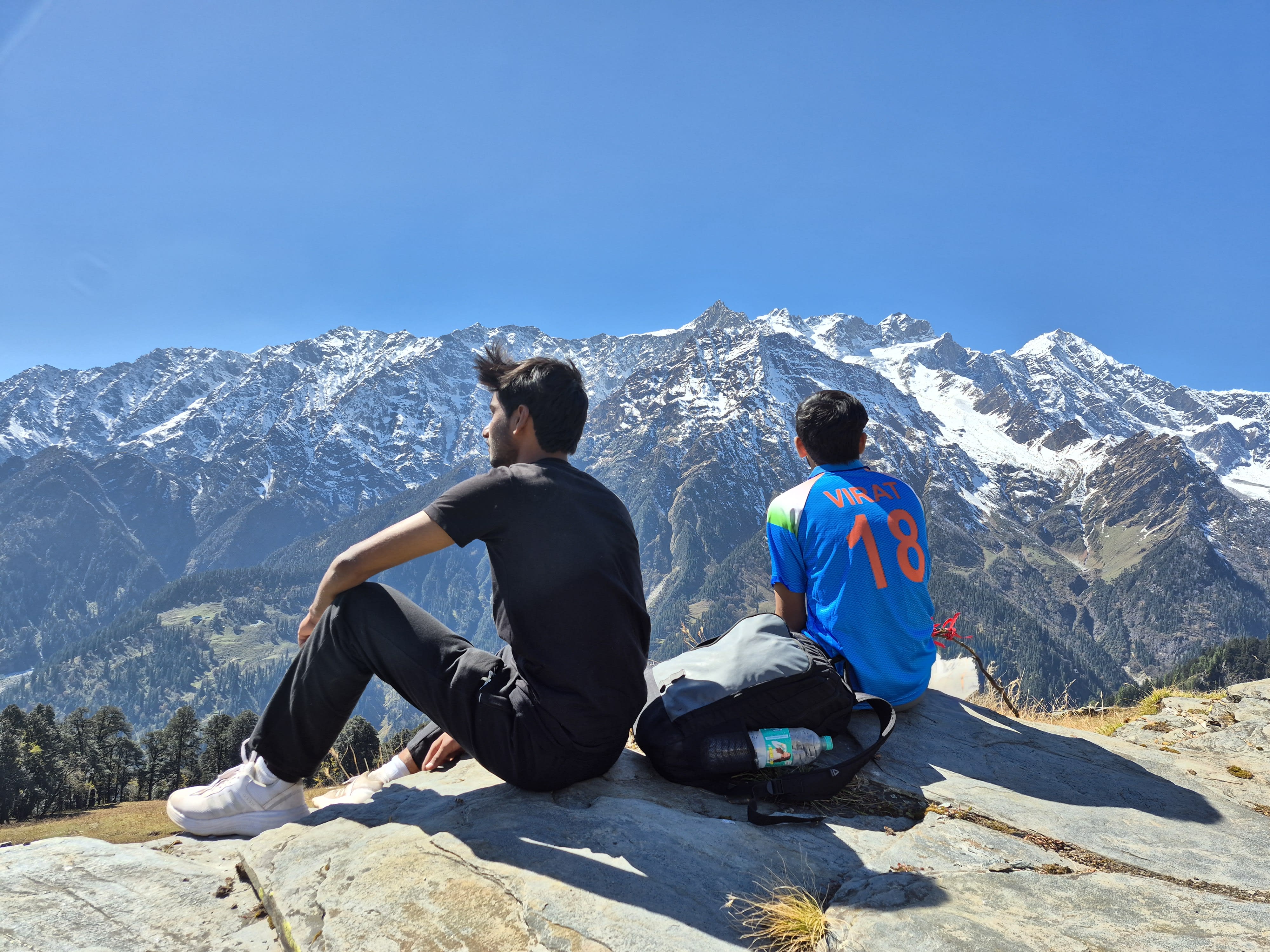
Patalsu Peak
The Premier 4,000m Beginner-Friendly Trekking Peak in Manali • Non-Technical Summit • 1-Day Speed Hike Route
Alpine Field Dossier • Route Metrics
About Patalsu Peak Trek
Rising directly above Solang Valley, Patalsu Peak (4,261m) is Manali’s premier non-technical 4,000-meter trekking peak. The relentless +1,781m vertical ascent climbs through ancient deodar woods and Shagadugh meadows before tackling the wind-scoured scree ridge opposite Hanuman Tibba.
Dense Cedar Forest
Ascends through ancient deodar, pine, and birch groves directly above Solang Village, where cattle graze in sunlit glades.
Shagadugh Meadow
At 3,250m, the timberline breaks into sweeping alpine pastures with panoramic vistas of the Solang basin and Dhauladhar crest.
The Exposed Scree Ridge
The final 1,000m climb traverses narrow wind-blasted shale and loose rock directly opposite the colossal face of Hanuman Tibba (5,982m).
The Trail
A first-hand visual chronicle and field observations from Solang Village to the 4,261m crest.
October Autumn Ascent • 1-Day Alpine Speed-Hike (12–13 Hours Continuous)
“I did Patalsu as a continuous 12 to 13-hour single-day speed-hike in October with only minimal breaks. Conquering the +1,781m vertical gain in one push is an incredible test of mountain endurance, but for most trekkers, I strongly recommend doing this as a 2 to 3-day trek. Camping at Shagadugh gives your body time to acclimatize and lets you truly experience the peaceful forest before tackling the relentless loose scree on the summit ridge.”— Ashish, October Mountain Climb
Crucial Water Warning: Carry 2 to 4 Liters
Natural running water ends very early on this route, roughly 500 meters above Solang Village. The upper cedar forest, the autumn meadow at Shagadugh, and the entire summit ridge are dry. You must carry at least 2 to 4 Liters of water per person from the valley.
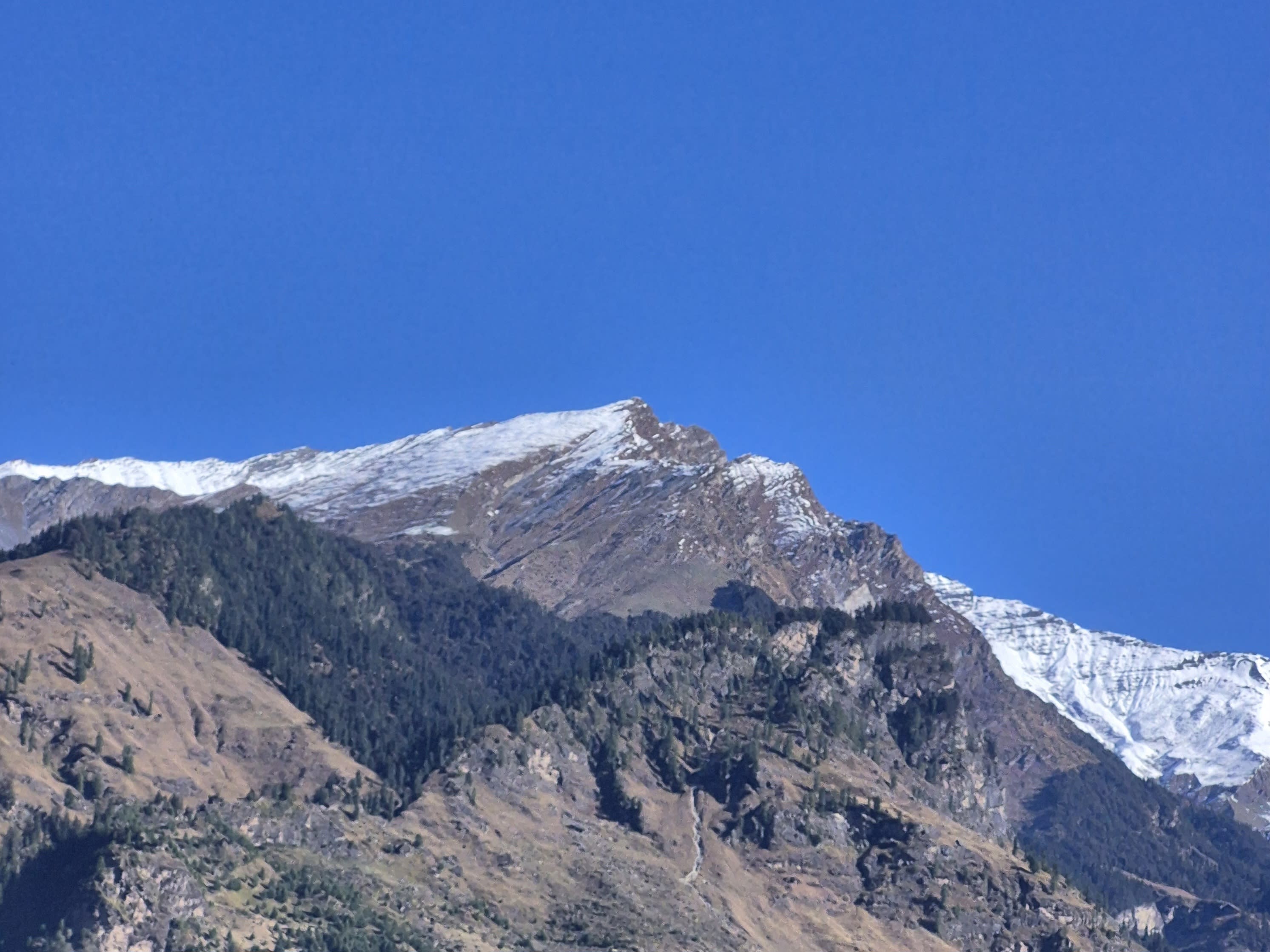
Looking at Patalsu Peak from Burwa Village
A clear morning view looking up at the 4,261m pyramid of Patalsu Peak from Burwa Village before heading toward the Solang trailhead.
“Standing at Burwa Village looking up at the mountain, you realize the scale of the +1,781 vertical meters ahead. There are no shortcuts.”
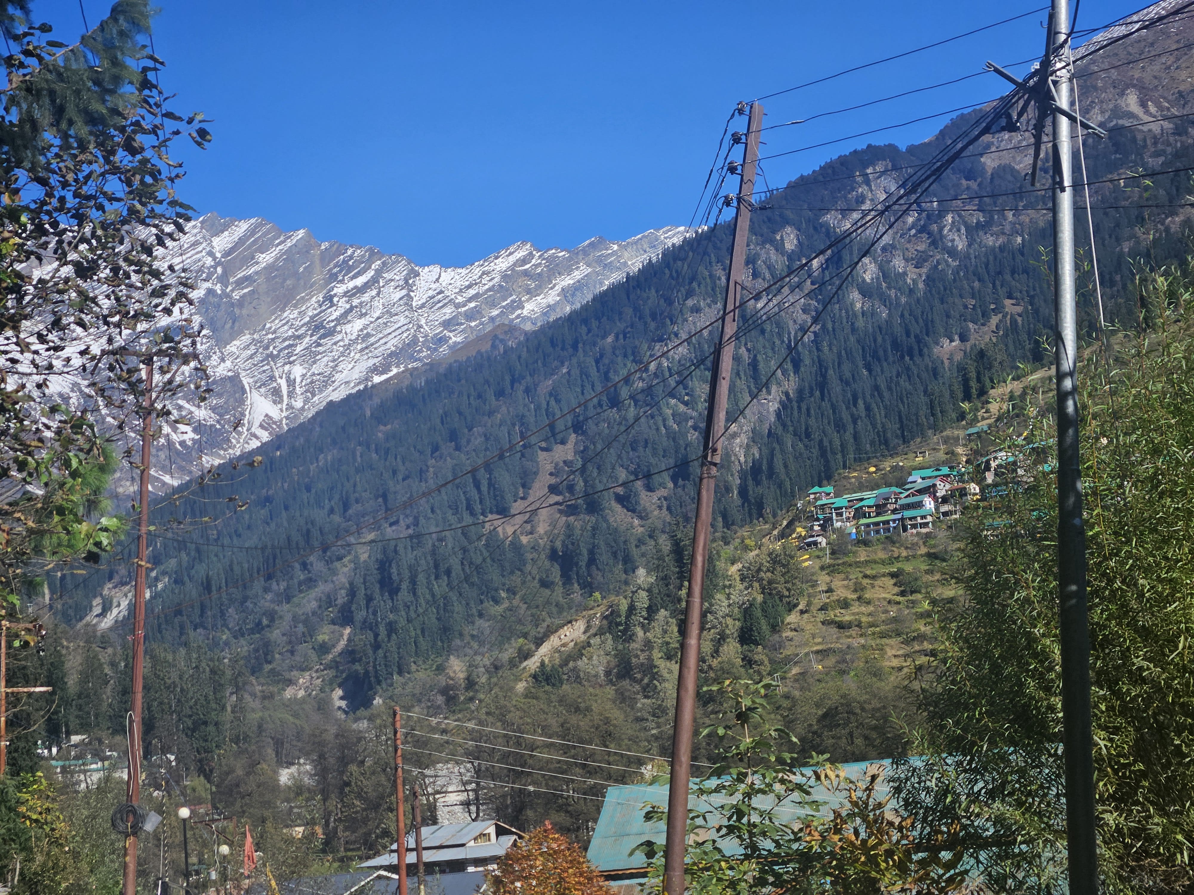
Solang Village Visible from Solang Valley
Looking across from Solang Valley toward Solang Village nestled on the mountainside as you cross the stream on the way to the trail start.
“Going to Solang Village — crossing the valley bridge as the traditional stone settlement comes into view.”
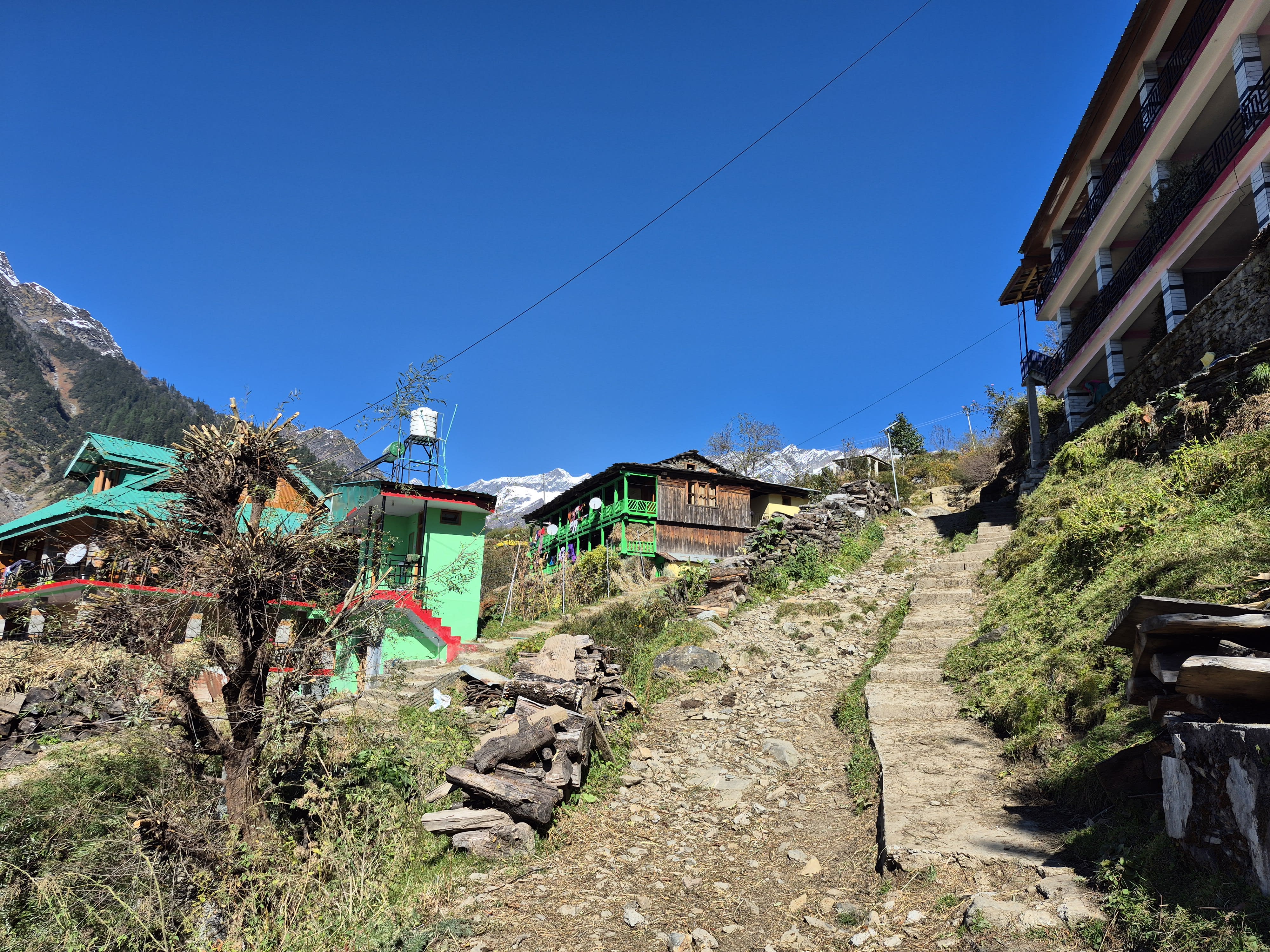
Traditional Timber & Stone Hamlet
Ancient Solang Village with its characteristic timber-framed stone homes, slate roofs, and apple orchards where the trail begins.
“The village is peaceful and quiet in early morning. Locals are heading out with their livestock as you take the trail upward.”
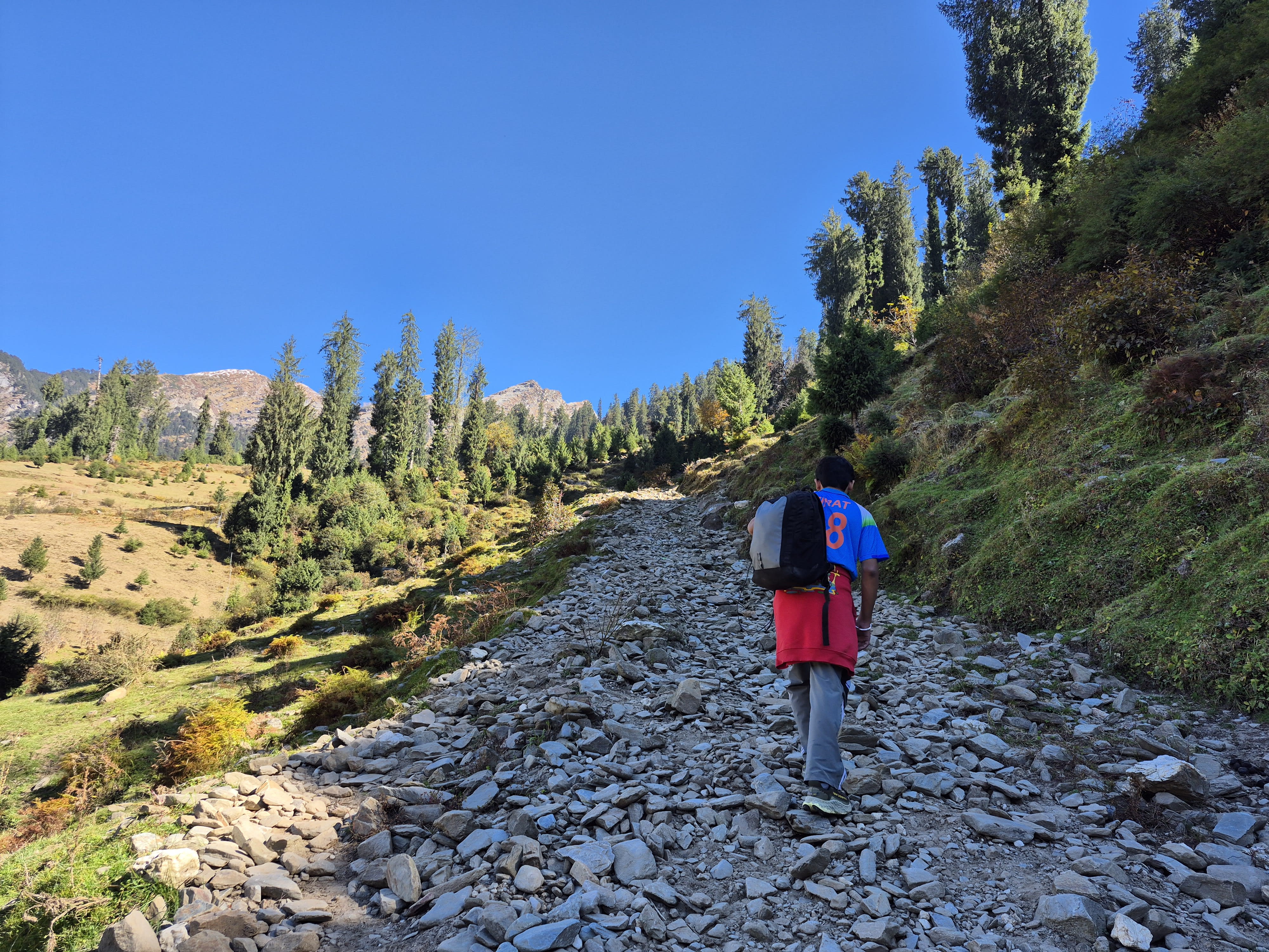
Entering the Cedar Forest
Stepping off the stone village lanes onto the dirt trail that plunges into dense deodar, pine, and birch woodland.
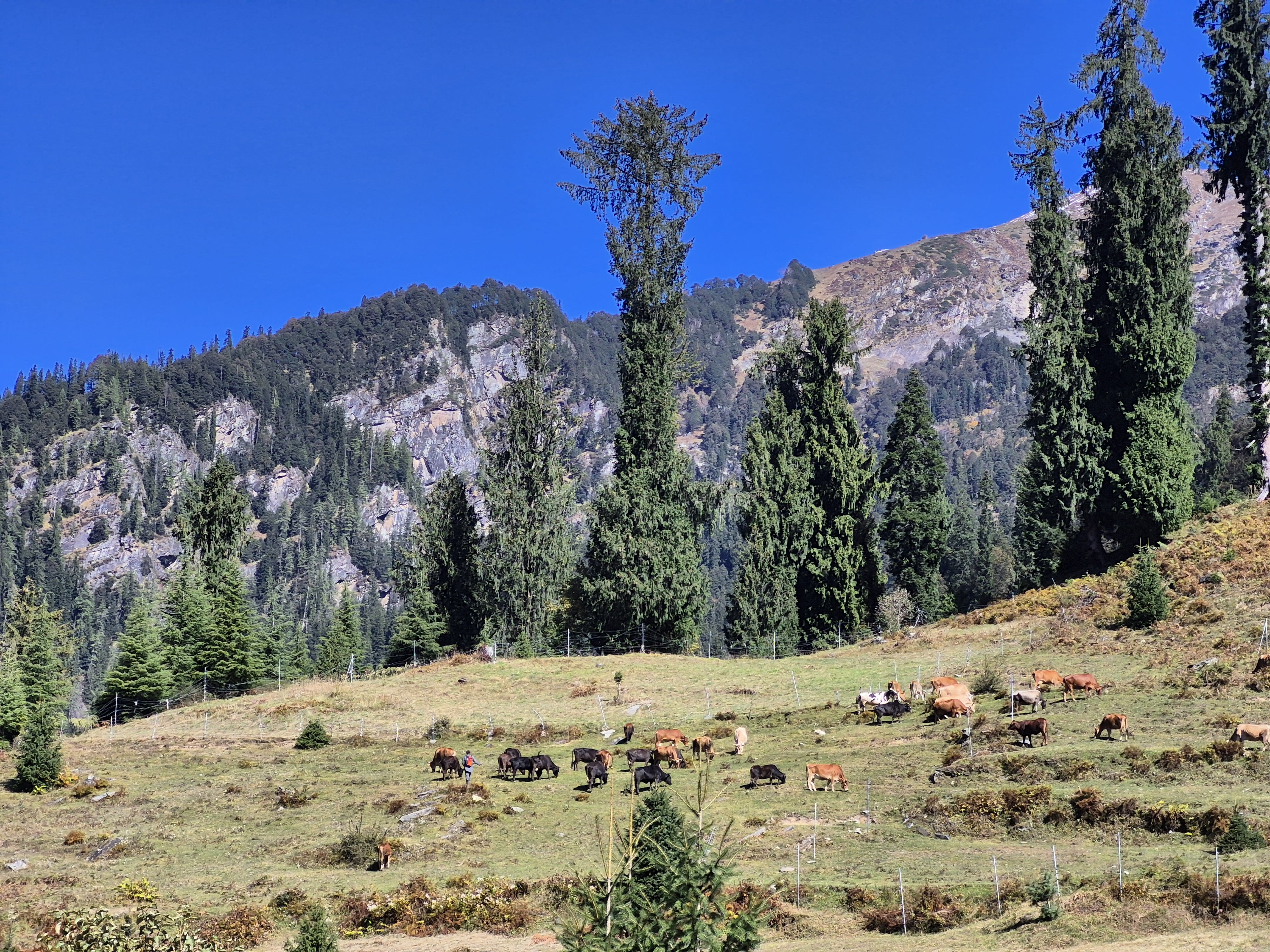
Pastoral Forest Glades
Tall cedars give way to sun-dappled glades where mountain cattle graze quietly in the morning light.
“The forest climb is steady and cool under the canopy, but the gradient never really lets up.”
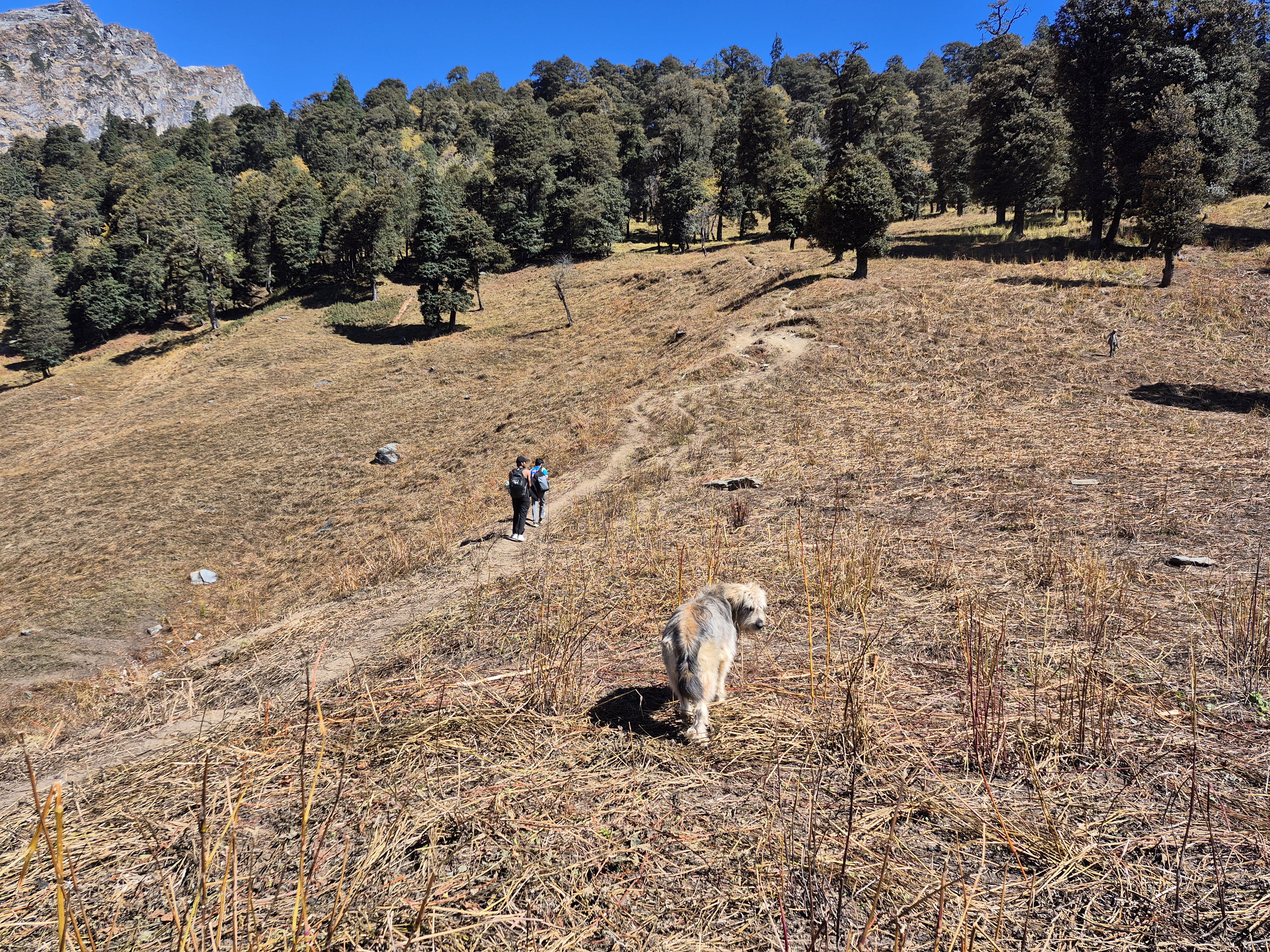
The Mountain Companion
A friendly local Himalayan sheepdog who joined our climb from the village and faithfully navigated the entire route with us.
“He appeared near the edge of the forest and stayed with us through the high meadow and onto the ridge. A true mountain spirit.”
Breaking Above the Treeline
Emerging into the high alpine meadow of Shagadugh. The forest abruptly ends, revealing the vast, sweeping panorama of the Dhauladhar ranges.
“This is the moment the whole climb changes. The trees fall away, the wind picks up, and you see the mountain spine ahead.”
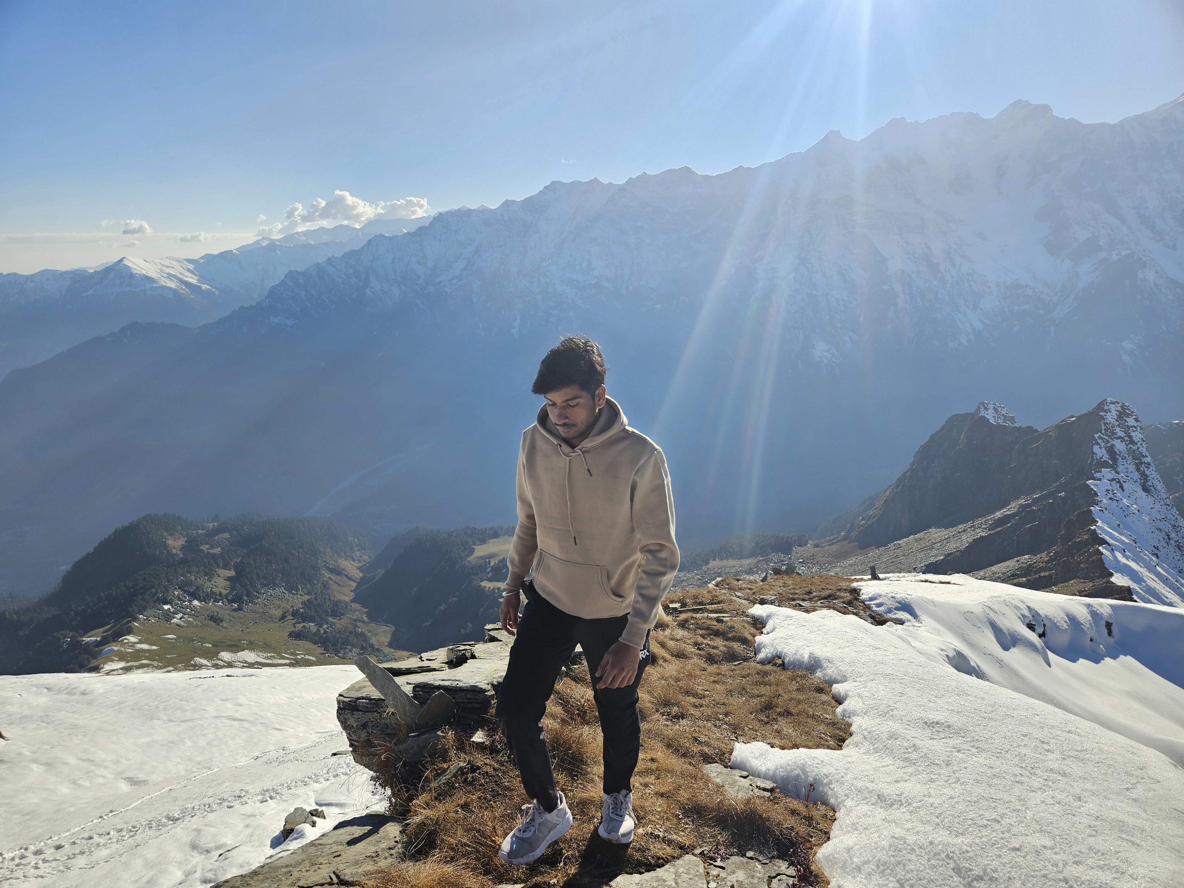
Ascending the Open Arête
The trail steepens dramatically across golden autumn grass slopes, transitioning steadily into rocky switchbacks along the mountain spine.
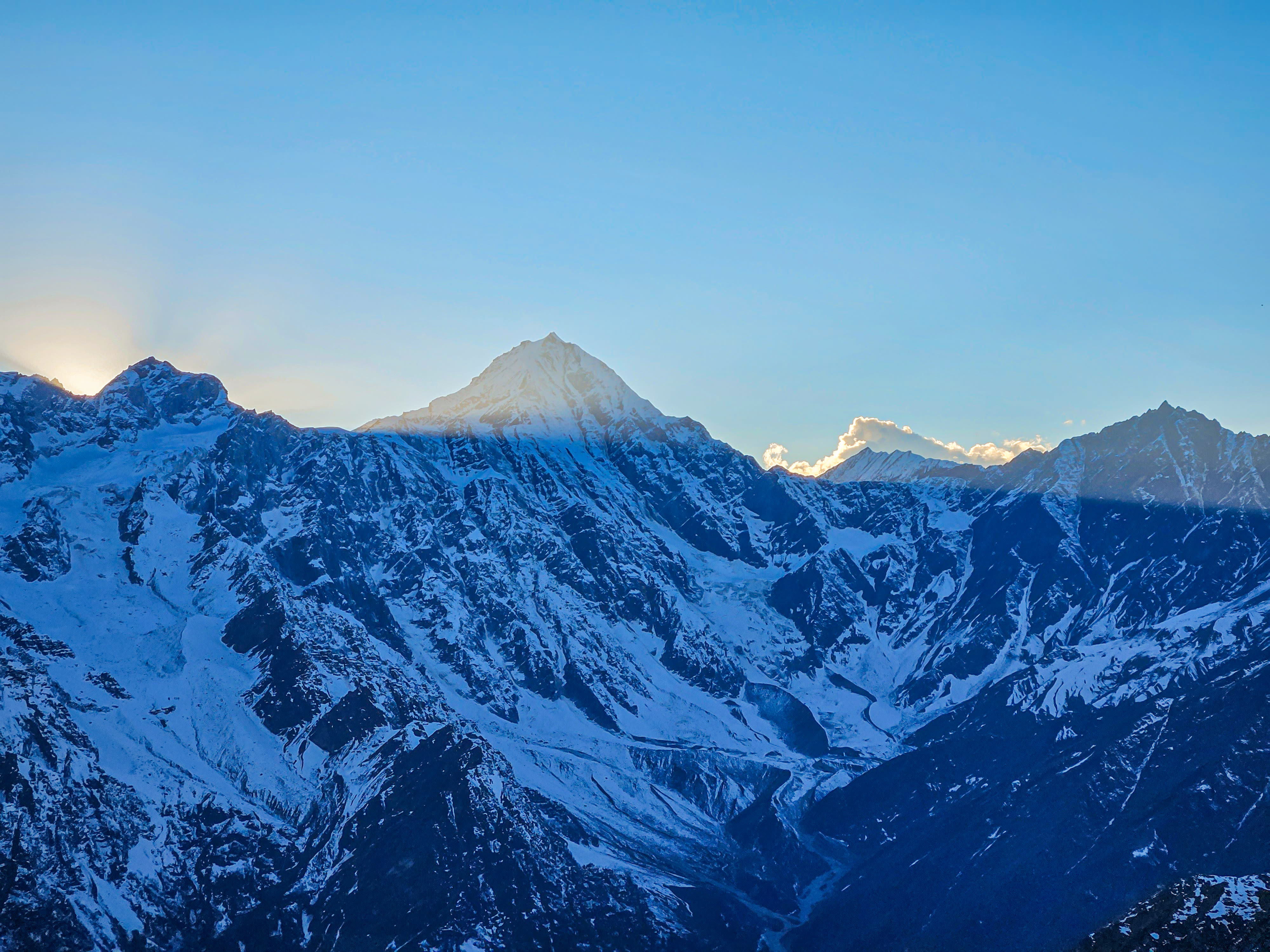
Facing Hanuman Tibba (5,982m)
Directly across the western abyss of Solang, the immense glaciated pyramid of Hanuman Tibba reveals its colossal sheer walls and hanging seracs.
“You are climbing Patalsu, but your eyes keep getting pulled to Hanuman Tibba. It feels so close you could almost touch the ice.”
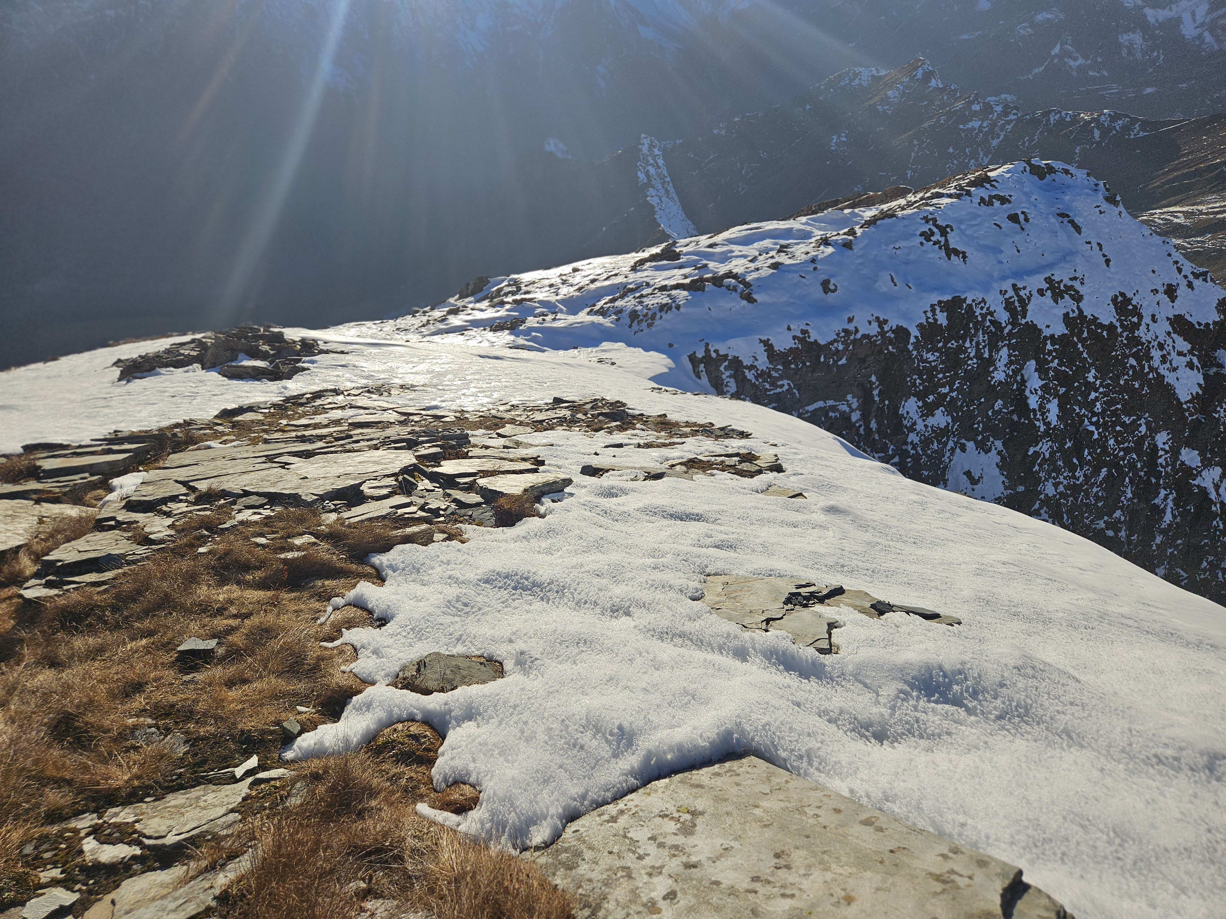
The Relentless Scree Ridge
The final 200m vertical push is an exposed knife-edge of loose shale and wind-scoured scree where deliberate, disciplined footing is mandatory.
“This was the most exhausting section. Two steps forward, half a step sliding back in the loose scree with cold autumn wind howling.”
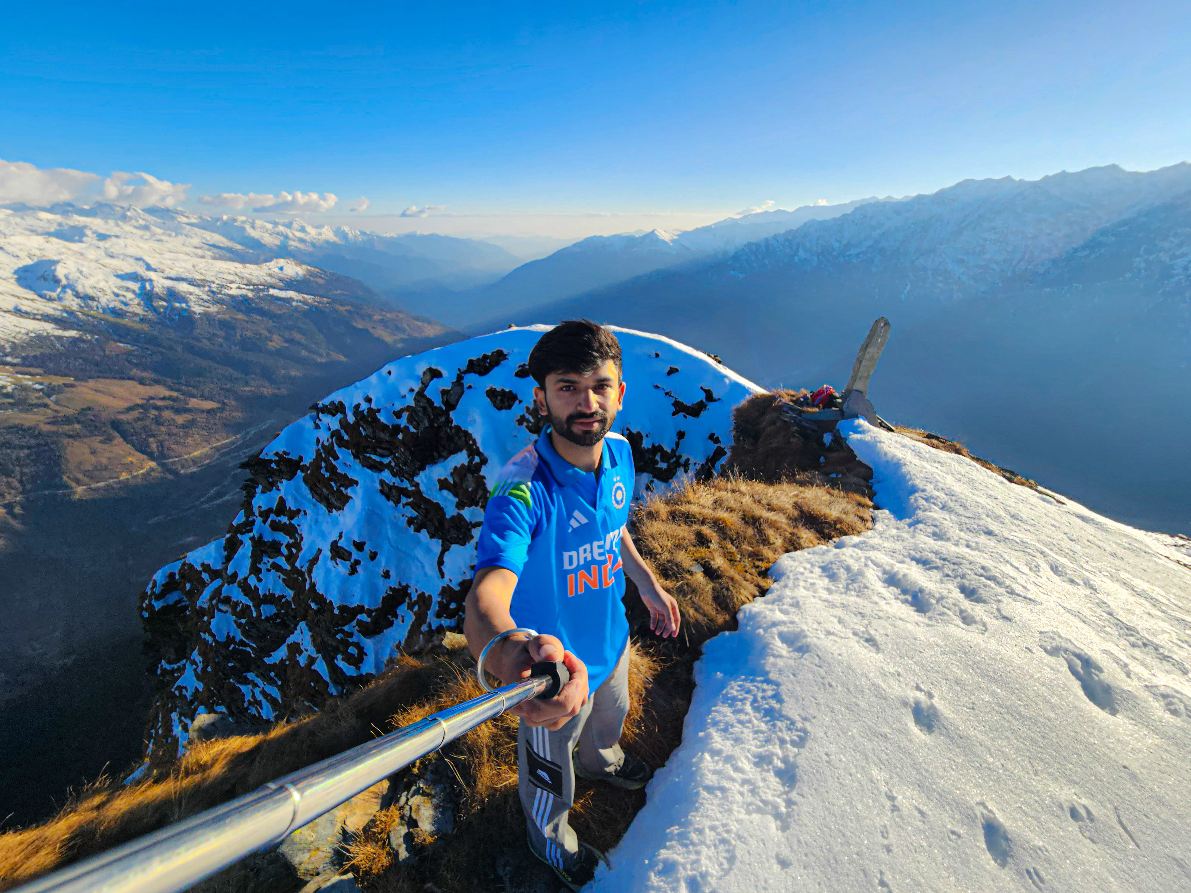
The 4,261m Summit Pinnacle
Standing on the pinnacle of Patalsu Peak with prayer flags fluttering in the freezing wind, rewarded with an unobstructed 360° Himalayan amphitheater.
“Reaching the summit cairn after hours of non-stop climbing was pure euphoria. The silence up here, looking over Pir Panjal and Lahaul, is absolute.”
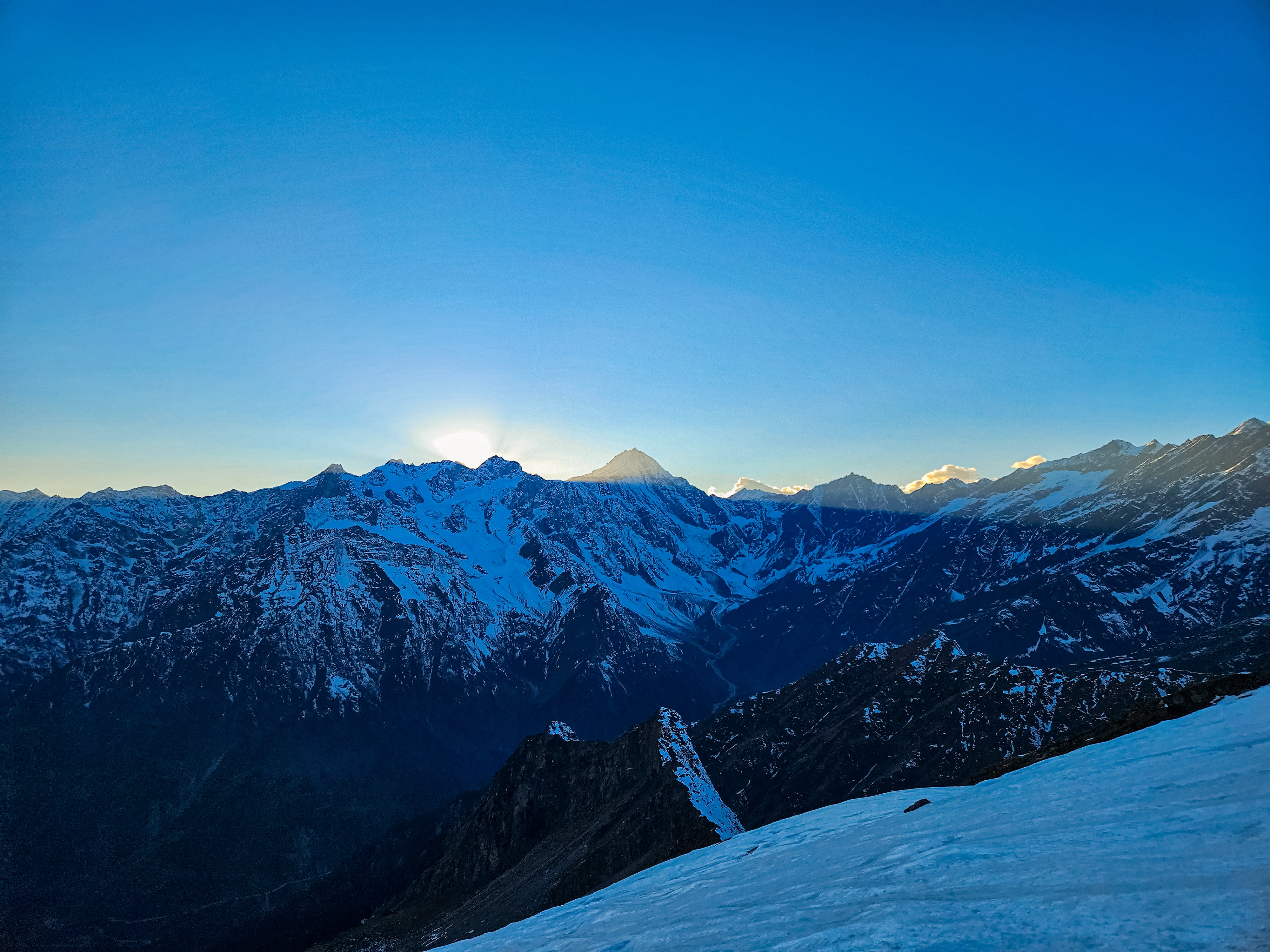
Alpenglow on Hanuman Tibba
On the long descent back down the mountain, the setting October sun set the west face of Hanuman Tibba ablaze in deep golden and crimson alpenglow.
“After 12 continuous hours on the mountain, watching this sunset while descending toward the valley made every single grueling step worth it.”
The Route
Trailhead coordinates, navigation milestones, and geospatial profile connecting Solang Village / Buruwa (2,480m) to the summit crest.
Solang Village / Buruwa (2,480m)
Kullu & Manali, Himachal Pradesh • Trailhead Access (14 km from Manali)
Patalsu Peak Trek (4,261 m)
360° vistas of Pir Panjal, Dhauladhar & Hanuman Tibba
32.3539° N, 77.1911° E
34 verified trail waypoints
Download GPX for Patalsu Peak Trek
Download the verified high-resolution GPS trail trace for Patalsu Peak Trek, recorded and validated directly on the mountain trail. Compatible with all handheld GPS units and smartphone navigation apps for offline route-finding.
Verified on 16 July 2020 • Recorded with Strava GPS / Phone by Ashish. All personal biometric timestamps and heart-rate telemetry have been completely stripped for clean, lightweight offline navigation.
- • Garmin & Suunto: Transfer file directly via Garmin Connect or Suunto App.
- • Gaia GPS & AllTrails: Select “Import GPX” to sync offline topo route.
- • Organic Maps & OsmAnd: Tap file on mobile to open in 100% offline maps.
Elevation Profile
Continuous vertical gradient from Solang Valley (2,480m) to the 4,261-meter summit crest with live slope & oxygen estimates.
Elevation & Slope Profile
Elevation Milestones • +1,781m Vertical Climb
- Base Trailhead
- Solang Village / Buruwa (2,480m)
- High Meadow Camp
- Shagadugh • 3,250 m
- Apex Summit Marker
- Patalsu Peak Trek • 4,261 m
Itinerary
Recommended day-by-day progression from Solang Village to the high meadows and summit ridge.
Solang Valley / Buruwa (2,480m) to Shagadugh Alpine Meadow (3,250m)
Depart Old Manali and head toward Solang Valley. The trail leaves the commercial resort road and ascends through ancient Solang Village with its traditional stone houses and wooden balconies. Enter dense cedar, pine, and oak forests where village cattle graze in quiet clearings. Emerge above the treeline into the expansive Shagadugh meadow. Camp overnight under the stars with commanding views of the Solang basin.
Summit Push: Shagadugh to Patalsu Peak (4,261m) & Return to High Camp
An alpine start at 5:00 AM to summit before midday convective clouds develop. Ascend steep grassy switchbacks that give way to an exposed, rocky ridgeline. As altitude increases, Hanuman Tibba (5,982m) looms in monumental scale directly across the valley. Battle the steep final 200m ridge of loose shale into bitter winds to reach the 4,261m summit. Enjoy an unrestricted 360° panorama of the Pir Panjal, Dhauladhar, and Rohtang pass before descending safely back to Shagadugh.
Shagadugh Meadow to Solang Valley & Return to Old Manali (2,050m)
Wake to golden morning sunlight sweeping across the upper Kullu peaks. Enjoy a warm camp breakfast before descending through the pine forests to Solang Village. Celebrate with hot chai and paranthas at the valley trailhead before returning to Old Manali.
1-Day Alpine Speed-Hike (12–13 Hours Continuous)
Seasoned alpine trail runners and acclimatized hikers with high cardiovascular fitness can tackle Patalsu as a single continuous day push. Starting at 5:00 AM from Solang Village, ascend through the cedar woods, clear Shagadugh meadow by mid-morning, navigate the loose scree summit ridge, and return before dusk. Carry at least 2 to 4 liters of water and high-energy trail fuel.
Information
Everything you need for a safe and prepared journey — real-time weather, seasonal cycles, practical field tips, medical directives, and gear checklist.
Best Time & Live Mountain Weather
Summer & Spring Snow (May – June)
Lush meadows in Shagadugh, pleasant daytime temperatures (12°C to 18°C), with crisp snow patches on the high summit crest — ideal for snow Manali treks.
Monsoon (July – August)
Dense pine woodland is vibrant and green. Convective clouds gather by early afternoon; 5:00 AM alpine departures are critical to summit safely.
Post-Monsoon / Autumn (Sept – Oct)
Crisp, transparent atmosphere with sharpest panoramic visibility of Hanuman Tibba and Dhauladhar ranges. Ideal window for speed hiking.
Winter (Nov – April)
Upper meadows and ridge buried under heavy snow drifts. Snow trekking to Shagadugh (3,250m) is accessible; summit push requires winter mountaineering equipment.
Trail Tips & Practical Advice
Water Warning: Natural water sources end very early, roughly 500 meters above Solang Village. There is no reliable water along the upper forest, Shagadugh (dry in late season), or the summit ridge. You must carry at least 2 to 4 Liters of water from the start.
Duration Recommendation: While trail runners and seasoned endurance hikers can tackle this as a grueling 12–13 hour single-day speed-hike, we strongly recommend 2 to 3 days for standard trekkers with a camp at Shagadugh meadow (3,250m).
Early Alpine Start: Start before dawn (5:00 AM) to summit before afternoon cloud buildups and gale winds, and to avoid descending the steep, slippery forest sections in total darkness.
Scree Footing & Poles: The final 200m vertical ascent traverses narrow, wind-swept loose scree and fractured shale. Sturdy boots with deep traction lugs and trekking poles are non-negotiable for balance.
Wind Protection: Even during clear October weather, winds on the exposed 4,200m ridge are bitterly cold. Carry a windproof shell jacket, warm beanie, and thermal gloves.
No special inner-line permits are required. Normal forestry and local trailhead registration at Solang Village apply.
Altitude Safety & Emergency Protocols
The Three Golden Rules of Altitude Safety
- 1Rule 1: Any headache or illness above 2,500m is Acute Mountain Sickness (AMS) until proven otherwise.
- 2Rule 2: Never ascend to sleep at a higher campsite with symptoms of altitude sickness.
- 3Rule 3: If symptoms worsen, or if ataxia (loss of balance) or breathlessness at rest appears, descend immediately.
What to Pack
Essential alpine gear required for Patalsu's steep scree ascent, wind-blasted 4,200m ridge, and dry upper sections.
Frequently Asked Questions
Clear answers regarding distance, altitude, how to reach, opening hours, winter conditions, and permits for Patalsu Peak Trek.
More Trails in Kullu & Manali
Continue your journey through neighboring valleys, glacier basins, and trails across Kullu & Manali.
Beas Kund Trek
Beas Kund (also revered as Vyas Kund) is the sacred high-altitude glacial tarn (3,700m / 12,139 ft) from which the River Beas (ancient Vipasha) originates. Nestled directly beneath the colossal amphitheater of Friendship Peak (5,289m), Shitidhar (5,290m), Ladakhi Peak (5,345m), and the jagged pyramid of Hanuman Tibba (5,982m), it represents one of the most scenic and rewarding alpine treks in the Upper Solang Valley of Manali. The 15.5 km round-trip trail begins at the Dhundi Bridge checkpoint (2,840m) on the roaring headwaters of the Beas, climbing through ancient silver birch (Bhojpatra) and deodar woodlands to the broad glacial floodplain of Bakarthach (3,300m). Beyond the shepherd meadows, the trail ascends steeply over rugged terminal moraines, granite boulder fields, and hanging glacier ridges to reveal the serene, turquoise tarn cradled at 3,700 meters.
Lamadugh Meadow
Lamadugh is a serene meadow nestled in the dense deodar and oak forests above Manali. The trail offers a gentle ascent through shaded woodland paths, opening up to a vast alpine clearing at around 3,300 meters.
Jogni Falls Trek
Jogni Falls (Jogini Waterfall) is a sacred 150-foot cascading cataract plunging down sheer granite cliffs in the Kullu Valley above Vashisht village, approximately 4 km from Manali. Revered by local villagers as the sacred dwelling of the village Joginis (protective female deities), the trail departs from Vashisht temple square and ascends gently through fragrant deodar woods, ancient pine forests, and terraced apple orchards. The trail features two distinct stages: the lower tiered cascades and boulder streams where glacial waters rush violently over smooth rocks, followed by a steeper dirt trail winding through tree roots and crags up to the grand upper amphitheater. Here, the full vertical plunge crashes into a crystalline plunge pool, drenching hikers in invigorating glacial spray while framing sweeping vistas of the Beas Valley and snow-draped Pir Panjal crests.