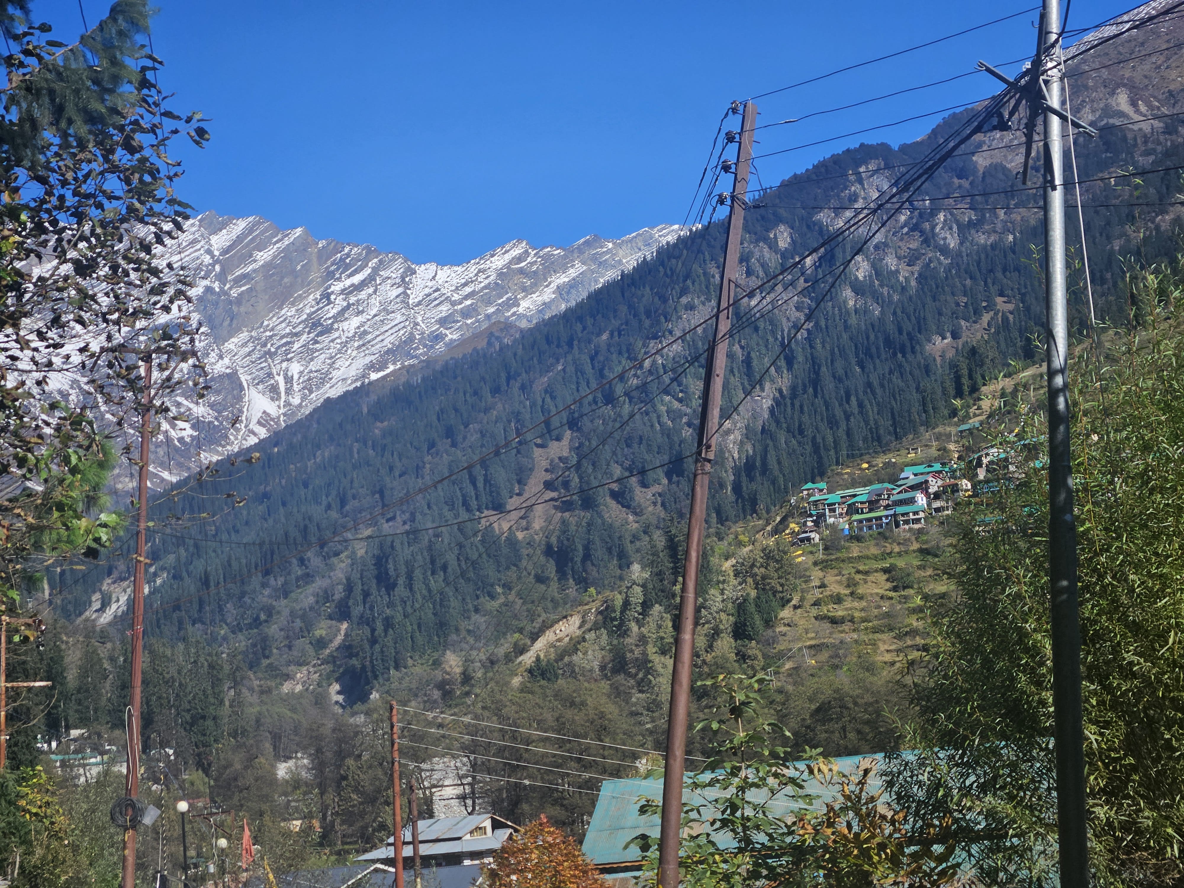
Solang Valley
Solang Valley lies 14 km northwest of Manali and serves as the gateway to the Beas Kund glacier and Patalsu Peak trails. It features skiing slopes in winter and paragliding in summer.
About Solang Valley
Solang Valley lies 14 km northwest of Manali and serves as the gateway to the Beas Kund glacier and Patalsu Peak trails. It features skiing slopes in winter and paragliding in summer.
Key Place Highlights & Field Notes
Alpine Landscape & Setting
Perched at 2,560 m, offering expansive vistas of glaciated ridges and seasonal valley vegetation.
Best Exploration Timing
Optimal conditions occur during Year-round, when mountain roads and viewing corridors remain accessible.
Photographic Vantage Points
Early morning golden hour offers optimal atmospheric clarity across surrounding snow peaks before thermal cloud cover builds.
Reaching Solang Valley
Practical approach guidelines, road accessibility, and high-altitude meteorological conditions in Kullu & Manali, Himachal Pradesh.
Roadhead & Approach Transit
Accessible via the road network of Kullu & Manali, connecting through major Himalayan arteries. Local taxi unions and state transport operate seasonal schedules depending on weather clearance.
Trail & Walking Requirement
A modest walk or well-marked trail leads to the primary destination. Sturdy footwear is recommended on rocky steps and loose gravel surfaces.
Seasonal Window & Snow Clearance
Best visited during Year-round. High-altitude sections may experience heavy winter snowfall, temporarily closing vehicle access between December and March.
Mountain weather can change rapidly. Check local administration updates and avalanche warnings during active precipitation.
Seasons & Atmospheric Cycles
Primary Window: Year-roundHow weather, road accessibility, light quality, and landscape character shift across the four Himalayan cycles at Solang Valley.
Spring
March – MayCarry layered fleece and windproofs; afternoon showers common during seasonal transitions.
Summer
June – AugustMonsoon rains impact lower foothills (July–Aug); check highway landslide bulletins.
Autumn
September – NovemberTemperatures drop sharply after dusk; heavy thermal wear essential by late October.
Winter
December – FebruarySub-zero overnight chills; 4x4 vehicles with snow chains recommended on icy inclines.
Geospatial & Topographic Profile
Explore Solang Valley's elevation contours, ridgelines, and glacial relief in interactive cartography and 3D satellite mesh.
Interactive 3D Satellite Terrain
Inspect the 3D glacial topography, ridge relief, and trail approaches of Solang Valley in photorealistic satellite imagery.
Planning Your Visit to Solang Valley
Authoritative field answers concerning altitude, seasonal access, and travel logistics.
Nearby Destinations & Trails in Kullu & Manali
Explore neighboring passes, cultural villages, and trails within the same mountain corridor.
Beas Kund Trek
Beas Kund (also revered as Vyas Kund) is the sacred high-altitude glacial tarn (3,700m / 12,139 ft) from which the River Beas (ancient Vipasha) originates. Nestled directly beneath the colossal amphitheater of Friendship Peak (5,289m), Shitidhar (5,290m), Ladakhi Peak (5,345m), and the jagged pyramid of Hanuman Tibba (5,982m), it represents one of the most scenic and rewarding alpine treks in the Upper Solang Valley of Manali. The 15.5 km round-trip trail begins at the Dhundi Bridge checkpoint (2,840m) on the roaring headwaters of the Beas, climbing through ancient silver birch (Bhojpatra) and deodar woodlands to the broad glacial floodplain of Bakarthach (3,300m). Beyond the shepherd meadows, the trail ascends steeply over rugged terminal moraines, granite boulder fields, and hanging glacier ridges to reveal the serene, turquoise tarn cradled at 3,700 meters.
Lamadugh Meadow
Lamadugh is a serene meadow nestled in the dense deodar and oak forests above Manali. The trail offers a gentle ascent through shaded woodland paths, opening up to a vast alpine clearing at around 3,300 meters.
Jogni Falls Trek
Jogni Falls (Jogini Waterfall) is a sacred 150-foot cascading cataract plunging down sheer granite cliffs in the Kullu Valley above Vashisht village, approximately 4 km from Manali. Revered by local villagers as the sacred dwelling of the village Joginis (protective female deities), the trail departs from Vashisht temple square and ascends gently through fragrant deodar woods, ancient pine forests, and terraced apple orchards. The trail features two distinct stages: the lower tiered cascades and boulder streams where glacial waters rush violently over smooth rocks, followed by a steeper dirt trail winding through tree roots and crags up to the grand upper amphitheater. Here, the full vertical plunge crashes into a crystalline plunge pool, drenching hikers in invigorating glacial spray while framing sweeping vistas of the Beas Valley and snow-draped Pir Panjal crests.
Continue Your Journey Through Himachal Pradesh
Discover verified routes, high-altitude passes, and cultural field guides across the Himalayas.