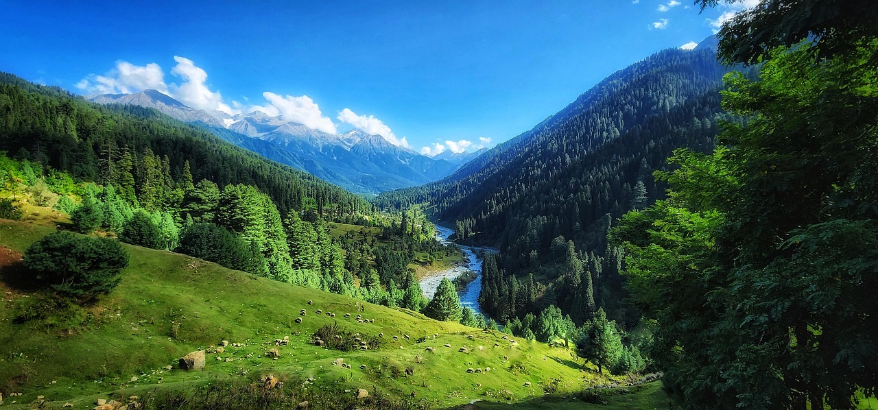
Pahalgam
Known as the 'Valley of Shepherds', Pahalgam sits at the confluence of the roaring Lidder River and Sheshnag stream in Anantnag district. Framed by thick pine forests, towering limestone cliffs, and lush meadows like Baisaran and Betaab Valley, Pahalgam serves as Kashmir's premier valley retreat and the primary mountaineering base camp for treks to the Kolahoi Glacier, Tarsar-Marsar lakes via Aru Valley, and the traditional Amarnath Yatra pilgrimage trail.
About Pahalgam
Known as the 'Valley of Shepherds', Pahalgam sits at the confluence of the roaring Lidder River and Sheshnag stream in Anantnag district. Framed by thick pine forests, towering limestone cliffs, and lush meadows like Baisaran and Betaab Valley, Pahalgam serves as Kashmir's premier valley retreat and the primary mountaineering base camp for treks to the Kolahoi Glacier, Tarsar-Marsar lakes via Aru Valley, and the traditional Amarnath Yatra pilgrimage trail.
“The thunderous roar of the emerald Lidder River rushing through deodar forests beneath jagged alpine summits.”
Key Place Highlights & Field Notes
Take a day excursion or hike up to Aru Valley (12 km) and Baisaran meadow.
Lidder River offers excellent regulated brown trout angling during summer with local department permits.
Reaching Pahalgam
Practical approach guidelines, road accessibility, and high-altitude meteorological conditions in Kashmir, Jammu & Kashmir.
Roadhead & Approach Transit
Accessible via the road network of Kashmir, connecting through major Himalayan arteries. Local taxi unions and state transport operate seasonal schedules depending on weather clearance.
Trail & Walking Requirement
Direct vehicular access is generally available to main viewpoints, with light walks required to explore adjoining ridgelines and village lanes.
Seasonal Window & Snow Clearance
Best visited during April to October. High-altitude sections may experience heavy winter snowfall, temporarily closing vehicle access between December and March.
Mountain weather can change rapidly. Check local administration updates and avalanche warnings during active precipitation.
Seasons & Atmospheric Cycles
Primary Window: April to OctoberHow weather, road accessibility, light quality, and landscape character shift across the four Himalayan cycles at Pahalgam.
Spring
March – MayCarry layered fleece and windproofs; afternoon showers common during seasonal transitions.
Summer
June – AugustMonsoon rains impact lower foothills (July–Aug); check highway landslide bulletins.
Autumn
September – NovemberTemperatures drop sharply after dusk; heavy thermal wear essential by late October.
Winter
December – FebruarySub-zero overnight chills; 4x4 vehicles with snow chains recommended on icy inclines.
Geospatial & Topographic Profile
Explore Pahalgam's elevation contours, ridgelines, and glacial relief in interactive cartography and 3D satellite mesh.
Interactive 3D Satellite Terrain
Inspect the 3D glacial topography, ridge relief, and trail approaches of Pahalgam in photorealistic satellite imagery.
Planning Your Visit to Pahalgam
Authoritative field answers concerning altitude, seasonal access, and travel logistics.
Nearby Destinations & Trails in Kashmir
Explore neighboring passes, cultural villages, and trails within the same mountain corridor.
Kashmir Great Lakes Trek
Widely regarded as India's prettiest trek, the Kashmir Great Lakes trail traverses seven pristine alpine lakes—including Vishansar, Kishansar, Gadsar, Satsar, and Gangabal—nestled against sheer glaciated cirques.
Tarsar Marsar Trek
A mesmerizing trek in the Aru Valley of Kashmir leading to the twin almond-shaped alpine lakes of Tarsar and Marsar, surrounded by lush meadows and the Kolahoi mountain massif.
Sonmarg & Thajiwas Glacier
Sonmarg ('Meadow of Gold') is framed by soaring glaciers and the roaring Sindh River in Ganderbal district. Sited along the Srinagar-Leh highway, it serves as the threshold between Kashmir and Ladakh via Zojila Pass. A gentle 3 km trail leads to the foot of the Thajiwas Glacier, while nearby Baltal valley acts as a primary base camp for the holy Amarnath Yatra. Sonmarg is also the starting point for the world-famous Kashmir Great Lakes trek.
Continue Your Journey Through Jammu & Kashmir
Discover verified routes, high-altitude passes, and cultural field guides across the Himalayas.